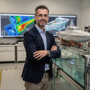
Diploma in Navigation Route Optimization
Why this certificate program?
The Diploma in Navigation Route Optimization
This program provides you with the tools and expert knowledge to reduce costs, minimize environmental impact, and maximize efficiency in the planning and execution of maritime routes. Learn to use specialized software, interpret meteorological and oceanographic data, and apply advanced strategies for safe and economical navigation. This program is ideal for professionals seeking to lead route optimization in the maritime industry.
Differentiating Advantages
- Cutting-edge Software: Master the market-leading tools for route planning and optimization.
- Advanced Data Analysis: Learn to interpret and utilize meteorological, oceanographic, and vessel performance data.
- Fuel-saving Strategies: Implement proven techniques to reduce fuel consumption and operating costs.
- Safe and Sustainable Navigation: Minimize the risk of incidents and reduce the environmental impact of maritime operations.
- Real-world Case Studies: Apply your acquired knowledge to practical situations and real-world industry challenges.
- Modality: Online
- Level: Diplomado
- Hours: 800 H
- Start date: 29-09-2026
Availability: 1 in stock
Who is it aimed at?
- Merchant Marine Officers and Captains seeking to optimize fuel consumption, reduce environmental impact, and improve navigational efficiency.
- Route planners and logistics operators interested in minimizing costs, complying with environmental regulations, and ensuring on-time deliveries.
- Maritime data analysts and naval consultants requiring advanced tools for route evaluation, weather forecasting, and optimized decision-making.
- Nautical and Marine Engineering students wishing to acquire specialized knowledge in efficient route management and the application of cutting-edge navigational technologies.
- Marine insurance and legal professionals seeking to understand Key factors in route optimization for risk assessment and dispute resolution.
Study flexibility
Adapted to your needs: online format with access to digital resources, personalized tutoring, and interactive discussion forums for collaborative and effective learning.
Objectives and competencies

Implement fuel-saving strategies:
Optimize the route considering weather and oceanographic conditions, communicating any deviations to the Captain and adjusting speed to minimize fuel consumption.

Reduce transit and delivery times:
Optimize route planning by considering currents, tides, and weather conditions to minimize time on the route.

Minimize the operating costs associated with transportation:
Optimize routes by considering factors such as currents, winds, and tides to reduce fuel consumption.

Manage available resources efficiently:
“Optimize consumption (fuel, water, lubricants) and plan preventive maintenance, minimizing costs and maximizing vessel availability.”

Use specialized software for optimal route design:
Integrate meteorological and oceanographic data to adjust the route and minimize risks, considering fuel consumption and estimated time of arrival (ETA).

Assess and mitigate risks inherent in navigation:
Analyze the environment, anticipate hazards (traffic, weather, sea conditions) and proactively adapt navigation.
Curriculum - Modules
- Comprehensive Maritime Incident Management: protocols, roles, and chain of command for coordinated response
- Operational Planning and Execution: briefing, routes, weather windows, and go/no-go criteria
- Rapid Risk Assessment: criticality matrix, scene control, and decision-making under pressure
- Operational Communication: VHF/GMDSS, standardized reports, and inter-agency liaison
- Tactical Mobility and Safe Boarding: RHIB maneuvers, approach, mooring, and recovery
- Equipment and Technologies: PPE, signaling, satellite tracking, and field data logging
- Immediate Care of the Affected: primary assessment, hypothermia, trauma, and stabilization for evacuation
- Adverse Environmental Conditions: swell, Visibility, flows, and operational mitigation
Simulation and training: critical scenarios, use of VR/AR, and exercises with performance metrics
Documentation and continuous improvement: lessons learned, indicators (MTTA/MTTR), and SOP updates
- Introduction to Advanced Navigation: Concepts and Tools
- Advanced Meteorology: Chart Interpretation, Long-Term Forecasting
- Oceanography: Ocean Currents, Waves, Wind Effects
- Sailboat/Motor Vessel Performance: Polar Diagrams, Route Optimization
- Long-Distance Route Planning: Factors to Consider
- Celestial Navigation: Basic Concepts, Instruments, Position Calculation
- Offshore Communications: Radio, Satellite, Emergency Protocols
- Onboard Energy Management: Batteries, Generators, Renewable Energy
- Survival at Sea: Equipment, Techniques, First Aid
- International Maritime Law: Conventions and Regulations relevant
‘
- Introduction to Marine Meteorology: Basic Concepts and Variables
- Onboard Meteorological Instrumentation: Barometers, Thermometers, Anemometers
- Observation and Recording of Meteorological Data: Formats and Protocols
- Interpretation of Synoptic Charts: Analysis of Isobars and Fronts
- Weather Forecasting Systems: Global and Regional Models
- Winds: Types, Formation, Local Effects, and the Beaufort Scale
- Waves and Swells: Generation, Propagation, and Effects on Navigation
- Sea Ice: Types, Formation, Detection, and Hazards to Navigation
- Storm Warning Systems: Reception, Interpretation, and Response
- Development of weather routes: optimizing safety and efficiency
‘
- Introduction to Electronic Navigation and its Evolution
- ECDIS Fundamentals: Standards, Chart Types, Formats, and Updates
- ECDIS Configuration: Safety Settings, Display, and Alarms
- Sensor Integration: GNSS, Gyro, Log, Echosounder, and their Influence on Performance
- Advanced Route Planning: Safety Criteria, Optimization, and Risk Management
- Navigation Monitoring: Alarms, Alerts, and Response to Critical Situations
- Performance Optimization: Fuel Consumption, Efficient Routes, and Time Management
- ECDIS Data Analysis: Interpretation and Use for Continuous Improvement
- Maintenance and Troubleshooting Problems: Basic procedures and best practices
Legal and regulatory aspects related to the use of ECDIS and performance
‘
- Introduction to nautical cartography: history, chart types, projections
- Cartographic symbology: interpretation of symbols, abbreviations, and notes
- Reference systems: datum, ellipsoid, geoids, and their implications
- Electronic Navigational Charts (ENC): S-57/S-63 standards, formats, and use
- ECDIS: configuration, functionalities, alarms, and safety messages
- Chart corrections: Notices to Mariners, nautical publications
- Electronic navigational charting: route planning, waypoints, distance and time calculations
- Sensor integration: GPS, AIS, radar, echosounder, and their influence on navigation
- Maritime safety: identification of Risks, preventive measures, and emergency management
International legislation and regulations: SOLAS, IMO, STCW, and their application to cartography and navigation
‘
- System Architecture and Components: Structural design, materials, and subsystems (mechanical, electrical, electronic, and fluid) with selection and assembly criteria for marine environments
- Fundamentals and Principles of Operation: Physical and engineering foundations (thermodynamics, fluid mechanics, electricity, control, and materials) that explain performance and operating limits
- Safety and Environmental (SHE): Risk analysis, PPE, LOTO, hazardous atmospheres, spill and waste management, and emergency response plans
- Applicable Regulations and Standards: IMO/ISO/IEC requirements and local regulations;
- Conformance criteria, certification, and best practices for operation and maintenance
- Inspection, testing, and diagnostics: Visual/dimensional inspection, functional testing, data analysis, and predictive techniques (vibration, thermography, fluid analysis) to identify root causes
- Preventive and predictive maintenance: Hourly/cycle/seasonal plans, lubrication, adjustments, calibrations, consumable replacement, post-service verification, and operational reliability
- Instrumentation, tools, and metrology: Measuring and testing equipment, diagnostic software, calibration and traceability; selection criteria, safe use, and storage
- Onboard integration and interfaces: Mechanical, electrical, fluid, and data compatibility; Sealing and watertightness, EMC/EMI, corrosion protection, and interoperability testing.
Quality, acceptance testing, and commissioning: process and materials control, FAT/SAT, bench and sea trials, go/no-go criteria, and evidence documentation.
Technical documentation and integrated practice: logs, checklists, reports, and a complete case study (safety → diagnosis → intervention → verification → report) applicable to any system.
- Introduction to Electronic Cartography: Formats, Standards, and Updates
- ECDIS: Configuration, Alarms, Symbols, and Security Settings
- Echosounders: Operating Principles, Data Interpretation, and Calibration
- Basic Meteorology: Atmospheric Pressure, Wind, Temperature, and Humidity
- Meteorological Instrumentation: Barometers, Anemometers, Thermometers, and Hygrometers
- Interpretation of Weather Maps: Isobars, Fronts, and Pressure Systems
- Marine Weather Forecasting: Information Sources and Alerts
- Integration of Meteorological Data into Voyage Planning
- Use of Meteorological Analysis Software and Tools
- Preventive Maintenance of Echosounding Equipment and meteorology
‘
Career opportunities
- Maritime Route Planner: Optimizing routes for efficiency and safety in shipping companies.
- Navigation Data Analyst: Evaluating and improving routes using software and historical data for maritime logistics companies.
- Navigation Efficiency Consultant: Advising shipping companies on best practices and technologies to optimize fuel consumption and reduce environmental impact.
- Navigation Software Developer: Designing and improving algorithms and tools for route optimization in maritime technology companies.
- Fleet Manager: Monitoring and optimizing routes for multiple vessels in fleet management companies.
- Maritime Transport Researcher: Developing models and strategies for route optimization in academic institutions or research centers.
- Maritime Safety Auditor: Evaluating the Safety and efficiency of shipping routes in marine insurance companies or regulatory agencies.
Port Logistics Specialist: Coordination of routes and operations to optimize the flow of goods in ports and maritime terminals.
“`
Admission requirements

Academic/professional profile:
Degree/Bachelor's degree in Nautical Science/Maritime Transport, Naval/Marine Engineering, or a related field; or proven professional experience in bridge/operations.

Language proficiency:
Recommended functional maritime English (SMCP) for simulations and technical materials.

Documentation:
Updated resume, copy of degree or seaman's book, ID card/passport, letter of motivation.

Technical requirements (for online):
Equipment with camera/microphone, stable connection, ≥ 24” monitor recommended for ECDIS/Radar-ARPA.
Admission process and dates

1. Online
application
(form + documents).

2. Academic review and interview
(profile/objectives/schedule compatibility).

3. Admission decision
(+ scholarship proposal if applicable).

4. Reservation of place
(deposit) and registration.

5. Induction
(access to campus, calendars, simulator guides).
Scholarships and grants
- Strategic Design: Master the tools to create efficient routes that minimize costs and reduce times.
- Specialized Software: Learn to use cutting-edge software for route analysis and optimization, improving decision-making.
- Data Analysis: Interpret meteorological, oceanographic, and maritime traffic data to predict and avoid risks.
- Maritime Regulations: Understand international regulations and how to apply them to ensure the safety and legal compliance of your operations.
- Case Studies: Apply the acquired knowledge through real-world case studies and simulations, developing skills Route optimization practices. Boost your career and your company’s efficiency with this specialized diploma.
Testimonials
“Thanks to the Diploma in Navigation Route Optimization, I was able to reduce my company’s transportation costs by 18% in just six months. I implemented the planning algorithms and logistics strategies I learned, optimizing our fleet’s routes and minimizing downtime. The knowledge I gained has been fundamental in improving the efficiency and profitability of our operations.”
This diploma program provided me with the necessary tools to optimize my company’s logistics management. Thanks to the knowledge I gained in port planning, risk analysis, and supply chain management, we were able to reduce delivery times by 15% and operating costs by 10% in the last quarter.
I implemented the optimization algorithms I learned in the diploma program to redesign my company’s delivery routes. We achieved an 18% reduction in fuel costs and a 12% increase in the number of daily deliveries, exceeding the project’s initial expectations.
I applied the optimization algorithms I learned in the diploma program to redesign my company’s delivery routes. The result was an 18% reduction in fuel costs and a 12% increase in delivery efficiency, exceeding the project’s initial expectations.
Frequently asked questions
Minimize the time, distance, cost, or fuel consumption needed to reach a destination.
Yes. The itinerary includes ECDIS/Radar-ARPA/BRM with harbor, ocean, fog, storm, and SAR scenarios.
Online with live sessions; hybrid option for simulator/practical placements through agreements.
Reduce transportation costs and improve efficiency in the delivery of goods or services, minimizing distances, travel time and fuel consumption.
Recommended functional SMCP. We offer support materials for standard phraseology.
Yes, with a relevant degree or experience in maritime/port operations. The admissions interview will confirm suitability.
Optional (3–6 months) through Companies & Collaborations and the Alumni Network.
Simulator practice (rubrics), defeat plans, SOPs, checklists, micro-tests and applied TFM.
A degree from Navalis Magna University + operational portfolio (tracks, SOPs, reports and KPIs) useful for audits and employment.
- Introduction to Electronic Cartography: History, Evolution, and Standards
- Electronic Chart Formats: Raster (RNC) vs. Vectorial (ENC)
Reference Systems: Datum, Map Projections, Coordinates
ENC Database Structure (S-57): Objects, Attributes, and Metadata
Chart Acquisition and Updating: Official Sources, Permissions, and Licenses
ECDIS Software: Configuration, Functionalities, and Basic Operation
Route Planning: Safety Criteria, Route Optimization, and Environmental Factors
Fuel Consumption Optimization: Speed, Current, Wind, and Sea State
Route Calculation: Distance, Heading, Estimated Time of Arrival (ETA)
Graphical Representation of the Route: Symbols, Notes, and Alarms
‘
Request information
Complete the Application Form.
Attach your CV/degree certificate (if you have it to hand).
Indicate your preferred cohort (January/May/September) and whether you would like the hybrid option with simulator sessions.
An academic advisor will contact you within 24–48 hours to guide you through the admission process, scholarships, and compatibility with your professional schedule.
Faculty
Eng. Tomás Riera
Full Professor
Eng. Tomás Riera
Full Professor
Eng. Sofía Marquina
Full Professor
Eng. Sofía Marquina
Full Professor
Eng. Javier Bañuls
Full Professor
Eng. Javier Bañuls
Full Professor
Dr. Nuria Llobregat
Full Professor
Dr. Nuria Llobregat
Full Professor
Dr. Pau Ferrer
Full Professor
Dr. Pau Ferrer
Full Professor
Cap. Javier Abaroa (MCA)
Full Professor
Cap. Javier Abaroa (MCA)
Full Professor