Master’s Degree in Underwater Geology and Ocean Floor Exploration
Why this master’s programme?
The Master’s Degree in Underwater Geology and Ocean Floor Prospecting
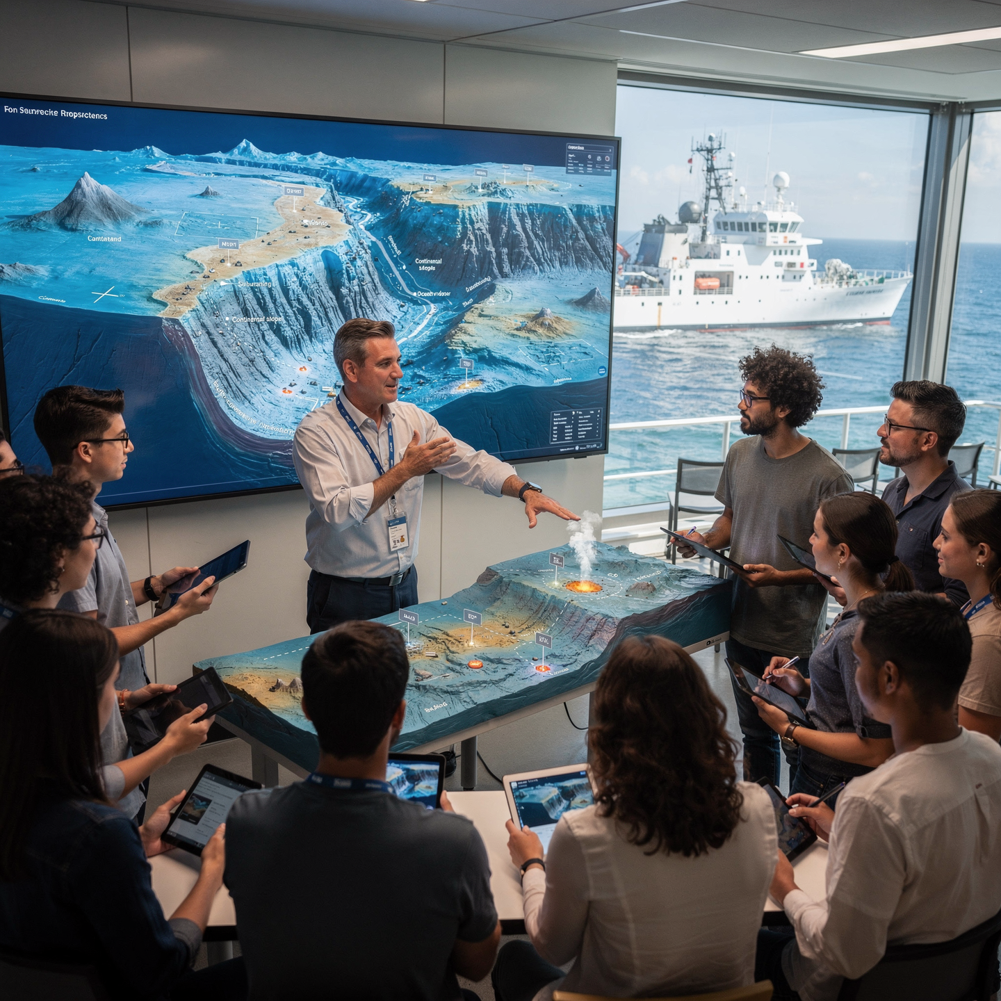
Immers you in the cutting edge of marine exploration, combining advanced geological knowledge with state-of-the-art prospecting technologies. You will learn to characterize the ocean subsurface, identify natural resources, and assess geological risks, preparing you for a future in research, industry, and environmental management.
Differential Advantages
- Practical Approach: analysis of seismic data, interpretation of geophysical logs, and 3D modeling of the seabed.
- Cutting-Edge Technologies: operation of ROVs, AUVs, and deep-sea sediment sampling systems.
- Virtual Expeditions: participation in simulations of oceanographic campaigns and analysis of real data.
- Industrial Collaboration: projects with leading companies in marine resource exploration and energy renewable.
- Sustainable development: application of marine geology to ecosystem conservation and climate change mitigation.
- Modality: Online
- Level: Masters
- Hours: 1600 H
- Start date:
Availability: 1 in stock
Who is it aimed at?
- Geologists and geophysicists seeking to specialize in marine environments and expand their skills in resource prospecting.
- Oceanographers and marine biologists interested in understanding the geology of the ocean floor and its influence on ecosystems.
- Mining and petroleum engineers requiring advanced knowledge in exploration and exploitation of resources on the seabed.
- Environmental consultants and public administration technicians requiring experience in the environmental impact assessment of underwater projects.
- Graduates in Marine Science, Geology, or Engineering seeking a career in the resource exploration and exploitation industry mariners.
Training flexibility
Designed for professionals and recent graduates: 24/7 accessible online content, personalized tutoring, and real-world case studies.
Objectives and skills

Assessing and mitigating geological risks in underwater engineering projects:
“Identify geological hazards (faults, landslides, seismicity), analyze their potential impact and develop contingency plans adapted to underwater conditions.”

Develop accurate geological models for the exploration and sustainable management of marine resources:
“Integrating advanced geophysical and geochemical data to model the distribution of deposits and assess their economic and environmental potential.”

Interpreting geophysical data for the comprehensive characterization of ocean floors:
“Analyze magnetic and gravimetric anomalies, seismic profiles, and bathymetric data to identify geological structures, sediment types, and potential resources on the seabed.”

Lead and supervise sampling and analysis campaigns of underwater sediments and rocks:
“Plan logistics, optimize resources and ensure the safety of personnel and equipment, complying with environmental regulations and scientific objectives.”
Design and optimize exploration strategies for the identification of underwater mineral and energy deposits:
Integrate advanced geospatial analysis, predictive modeling, and hyperspectral remote sensing to delineate high-potential areas and minimize the environmental impact of exploration.

Master advanced techniques for geological and geochemical mapping of the oceans:
Integrate geophysical data (seismic, magnetometry, gravimetry) with geochemical models for the holistic interpretation of the structure and composition of the seabed, identifying potential resources and hazards.
Study plan – Modules
- Fundamentals of geophysics applied to submarine exploration: principles of seismic, electromagnetic, and gravimetric wave propagation in marine environments
- Advanced instrumentation for geophysical mapping: multibeam sonar, side-scan sonar, high-resolution magnetometers, and magnetotelluric sensors
- Hydrographic data acquisition techniques: multibeam bathymetric survey methods, applications of submarine LiDAR, and subbottom profiler systems
- Processing and filtering of geophysical signals: seismic migration algorithms, static correction, spectral analysis, and ambient noise removal
- Structural interpretation of geophysical data: identification of faults, bends, and fractures in complex tectonic contexts
- Integration of geophysical data with satellite imagery and digital elevation models for three-dimensional characterization of the ocean floor
- Numerical modeling of submarine structures: simulation of geological deformations and prediction of mineral resource accumulation zones
- Application of structural analysis techniques for the prospecting of hydrocarbon reservoirs and mineral deposits in deep-sea environments
- Use of specialized software for geophysical interpretation and generation of thematic maps: Petrel, Oasis montaj, Geosoft, and Marine ArcGIS
- Management and planning of geophysical survey campaigns: design of profile lines, equipment calibration, and quality protocols in marine exploration
- Evaluation of submarine geological risks through structural analysis: landslides, induced tsunamis, and seismic risks on offshore platforms
- Emerging trends in geophysical mapping techniques: artificial intelligence applied to data interpretation and development of autonomous sensors for remote exploration
- Theoretical Foundations of 3D Seismics: Physical Principles, Generation and Propagation of Seismic Waves in Marine Environments
- Seismic Data Acquisition in Submarine Environments: Source and Receiver Technologies, Line Tracing, and Configuration of Operating Parameters
- Advanced Processing of 3D Seismic Data: Migration, Filtering, Time Correction, and Noise Removal for Signal Optimization
- Structural Interpretation: Identification and Modeling of Faults, Folds, Joints, and Stratigraphy of Ocean Basins
- Integration of Seismic Attributes: Amplitude, Frequency, and Coherence for the Detection of Anomalies Suggestive of Mineralization
- Three-Dimensional Geological Modeling: Creation of Georeferenced Volumetric Models for the Spatial Characterization of Submarine Mineral Bodies
- Petrophysical and Geochemical Evaluation Based on Indirect Data: Correlation with Logs
- Well drilling and sampling for validating mineral prospects
- Application of specialized software: introduction to industry-leading packages such as Petrel, Kingdom, and GeoProbe for integrated analysis
- Multidisciplinary interpretation: correlation of 3D seismic data with gravimetric, magnetic, and bathymetric data for comprehensive prospecting
- Practical examples and real-world case studies: prospecting for polymetallic nodules, manganese deposits, and submarine massive sulfides
- Optimizing the design of subsea exploration campaigns through seismic analysis: reducing uncertainties and focusing on high-potential areas
- Environmental and regulatory implications of subsea prospecting: impact assessment and applicable international regulations in geological exploration
- Emerging trends: artificial intelligence and machine learning in seismic interpretation and geological prediction in the marine environment
- Technical report and communication of Results: Structure, presentation, and defense of geological proposals for decision-making in underwater mining projects
[…]
- Fundamentals of geophysics applied to submarine environments: physical principles, properties of seismic, electromagnetic, and gravitational waves
- Advanced geophysical data acquisition techniques: 3D multibeam seismics, aeromagnetic surveying with autonomous vehicles, and high-resolution magnetometry
- Geophysical data processing and correction: noise filtering, seismic migration, and signal normalization for resolution improvement
- Three-dimensional structural analysis: interpretation of faults, folds, and dips in complex submarine contexts using specialized software
- Integrated geological modeling: construction of 3D models by integrating geophysical, geochemical, and geological data for characterization of rock formations and mineral deposits
- Detection and evaluation of submarine mineralized bodies: estimation methods of
- Reserves, density analysis, and physical properties for polymetallic resources and manganese nodules
- Application of advanced remote sensing techniques and underwater LiDAR systems for high-resolution topography and mapping of the ocean floor
- Geomechanics and stability of mineral deposits in submarine environments: assessment of geotechnical risks and stability modeling of slopes and submarine formations
- Geoinformatics and GIS systems for integration, visualization, and spatial analysis of geological and geophysical data in 3D
- Multidisciplinary case studies: sustainable exploitation and strategic planning in submarine mineral prospecting using predictive modeling and dynamic simulations
- Advanced design and configuration of autonomous underwater vehicles (AUVs) and remotely operated vehicles (ROVs) for geological applications: platform selection, payload, and adaptability to extreme oceanographic conditions
- Integration and calibration of multispectral, bathymetric, magnetometric, and seismic sensors in AUV/ROV systems: physical principles, accuracy, and operational tolerances
- Targeted sampling strategies using inertial navigation and acoustic positioning systems (USBL, LBL, SBL): route optimization and error minimization in complex environments
- Cross-validation protocols for data using integrated sensors to ensure quality and consistency in geophysical and geochemical surveys
- Implementation of advanced real-time sensor data processing techniques for operational decision-making: filtering, spectral analysis, and anomaly detection
- Application of underwater drones for the Environmental assessment: monitoring of biodiversity, anthropogenic impacts, and water quality in prospecting areas
International regulations and technical standards for AUV/ROV operations in marine protected areas and zones of high ecological value
Planning and execution of integrated oceanographic campaigns with AUV/ROV: logistics, risk management, and multidisciplinary coordination
Energy optimization and autonomy in extended prospecting missions: design of power systems and thermal management
Generation of technical reports and validated scientific documentation for presentation to regulatory bodies and stakeholders in the marine sector
- Fundamentals of marine geochemistry: chemical composition of seawater, biogeochemical cycles, and mineral dissolution and precipitation processes
- Dynamics of trace elements and heavy metals in marine environments: sources, transport, and sedimentation
- Water-rock-sediment interaction: geochemical mechanisms in mid-ocean ridges, hydrothermal vents, and geological vents
- Isotopic analysis in marine geochemistry: advanced techniques for the characterization and dating of submarine mineral deposits
- Hydrothermal alteration processes: formation of massive sulfuric (VMS) deposits and their relationship with geochemical fluids
- In situ geochemical detection methods: chemical sensors, automated samplers, and remote sensing applied to the ocean floor
- Application of
- Geochemistry in mineral prospecting
: Interpretation of geochemical anomalies to identify zones with metallogenic potential - Geochemical modeling of submarine systems: Simulations of metal dispersion and prediction of polymetallic deposits
- Advanced analytical techniques: Mass spectrometry, chromatography, and diffraction for the detailed analysis of marine samples
- Environmental impact and sustainability studies in geochemical prospecting: Risk assessment and mitigation during subsea exploration
- Fundamentals of geophysics applied to subsea exploration: principles of seismic wave propagation, magnetometry, gravimetry, and electromagnetic methods in marine environments
- Acquisition and processing of 3D seismic data: seismic campaign design, energy sources, signal reception and recording, filtering techniques, and noise reduction
- Detailed interpretation of seismic data: reflector identification, velocity analysis, mapping of geological structures, and characterization of subsea lithologies
- Advanced 3D geological modeling techniques: integration of seismic, bathymetric, geochemical, and geological data for the generation of three-dimensional models of reservoirs and structures
- Application of specialized software for geophysical modeling and visualization: use of platforms such as Petrel, Kingdom Suite, and Geosoft for spatial interpretation and analysis
- Quantitative evaluation of
- Ocean floor mineral resources: methods for reserve estimation, uncertainty analysis, and project scalability
- Geomechanics and stability of submarine deposits: study of the physical and mechanical properties of the substrate and their implications for safe extraction and exploitation
- Integration of geophysical and remote sensing methods for multi-thematic exploration: correlation with hydroacoustic data, multibeam sonar, and high-resolution bathymetric mapping
- International regulations and technical standards in submarine prospecting: environmental compliance, permits, and responsible management of non-renewable marine resources
- Case studies and applied simulations: analysis of real-world projects exploring strategic metals in ocean trenches, mid-ocean ridges, and hydrothermal deposits
- Theoretical Foundations and Physical Principles of Submarine Geophysical Mapping: Electromagnetic, Seismic, and Gravimetric Properties Applied to the Interpretation of Geological Structures in Deep Marine Environments
- Advanced Acquisition of 3D Geophysical Data: Multibeam Sensors, Seismic Reflection and Refraction Systems, Magnetometry, Gravimetry, and Multifrequency Sonar
- Seismic Data Processing and Treatment: Correction, Migration, Filtering, Spectral Analysis, and Seismic Attributes Techniques to Improve Resolution and Detection of Complex Structures
- Advanced Seismic Interpretation: Structural, Stratigraphic, and Attribute Analysis to Identify and Characterize Mineralized Bodies and Zones with Hydrothermal or Sedimentary-Metaliferous Potential
- Integration of Geophysical Data with Geological and Geochemical Information: Correlation Methods, 3D Modeling, and Generation of Mineralogy Susceptibility Maps
- Geological and numerical geological modeling applied to the prediction of subsea mineral resources: simulation techniques, reserve estimation, and uncertainty assessment
- Applications of artificial intelligence and machine learning for the automation of the interpretation and classification of geophysical patterns in 3D ocean floor data
- Design and execution of subsea prospecting campaigns: route planning, technology selection, data management, and safety and environmental protocols
- Case studies of successful prospecting on the ocean floor: analysis of polymetallic nodule deposits, massive sulfides, and crustacean cobalt deposits
- International regulations and environmental sustainability in subsea mining exploration and exploitation: legal framework, impact assessment, and responsible resource management
- Fundamentals of marine geochemistry: chemical composition of ocean waters and geochemical processes in submarine environments
- Sedimentary dynamics: transport, deposition, and diagenesis mechanisms in deep ocean basins
- Identification and characterization of submarine minerals: spectrometric, chromatographic, and advanced microscopy techniques
- Redox processes and biogeochemical cycles: their influence on the precipitation and concentration of metals in marine sediments
- Geochemical and sedimentary modeling for prospecting: application of specialized software and predictive analysis
- Isotopic studies to determine the age, origin, and evolution of submarine mineral deposits
- Interaction between submarine tectonics and sedimentary accumulation: structural controls in the formation of mineral deposits
- Advanced techniques Sampling and in-situ analysis: boreholes, rocks, sediments, and hydrothermal fluids
Environmental assessment: impact of deep-sea mining on geochemical processes and local sedimentary dynamics
Strategies for sustainable mining: integration of geochemical and sedimentary data to minimize risks and preserve marine biodiversity
- Fundamentals of marine geophysics: physical principles and properties of seismic, magnetic, gravitational, and electromagnetic waves applied to the submarine environment
- Advanced 3D geophysical data acquisition methodologies: multibeam seismic surveys, interferometry, vector magnetometry, and high-resolution gravimetry
- Geophysical image processing and treatment: filtering techniques, three-dimensional seismic migration, spectral analysis, and noise correction for signal optimization
- Structural interpretation in submarine environments: identification of faults, folds, dikes, and volcanic calderas using seismic and bathymetric integrations
- 3D numerical geological modeling: construction of three-dimensional models of sedimentary basins and mineral formations using specialized software such as Petrel, GOCAD, and Leapfrog
- Integration
- Geophysical and geological data analysis: correlation of seismic profiles with well logs, core samples, and bathymetric maps for the generation of robust prospecting maps
- Quantitative evaluation of mineral resources: estimation of reserves and modeling of mineralogical distributions on the ocean floor, including manganese deposits, massive sulfides, and polymetallic nodules
- Prospecting techniques based on artificial intelligence and machine learning: predictive analysis of geophysical anomalies and pattern recognition applied to large volumes of 3D data
- Application of emerging technologies: autonomous underwater drones (AUVs), remotely operated vehicles (ROVs) equipped with geophysical sensors for in-situ mapping and environmental monitoring
- Case studies and integrative projects: planning, execution, and critical review of underwater geophysical campaigns for the sustainable exploration and evaluation of mineral resources in diverse marine contexts
- Conceptualization and objectives of the final project: Multidisciplinary integration in submarine geology and ocean floor prospecting
- Advanced geophysical methodologies: Multibeam sonar, reflection and refraction seismics, magnetometry, and gravimetry for the characterization of the seabed
- Use of in situ sensors: Remotely operated vehicles (ROVs) and autonomous submersibles (AUVs) in the acquisition of geotechnical and geochemical data
- Geochemical and mineralogical analysis: Spectroscopy, X-ray diffraction, and electron microscopy techniques for the identification and quantification of mineral resources
- 3D modeling and numerical simulation for the structural evaluation and spatial distribution of submarine deposits
- Integration of hydroacoustic and oceanographic data for accurate estimation
- Environmental assessment and sustainability: ecological considerations, environmental impact, international legal framework, and methods for minimizing damage during mining operations
- Development of protocols for the management and continuous monitoring of areas of mining interest in deep-sea ecosystems
- Application of geographic information systems (GIS) for specialized mapping and comprehensive spatial analysis
- Scientific writing and professional presentation of the final report: structure, technical argumentation, conclusions, and strategic recommendations for the responsible exploitation of resources
Career prospects
“`html
- Exploration Geologist/Geophysicist: Participation in exploration campaigns for mineral and energy resources on the ocean floor.
- Marine Environmental Consultant: Assessment of the environmental impact of human activities on the marine environment and development of mitigation strategies.
- Research Scientist: Development of research projects at universities and marine research centers on submarine geology, plate tectonics, submarine volcanism, and climate change.
- Marine Resource Manager: Planning and management of the sustainable exploitation of mineral, energy, and biological resources in the marine environment.
- Marine Geological Hazard Analyst: Assessment and mitigation of risks associated with tsunamis, submarine landslides, and other marine geological phenomena.
- Marine Cartographer/Hydrographer: Surveying and creating maps and nautical charts of the ocean floor for safe navigation and resource management.
Marine Instrumentation Technician: Operation and maintenance of geological and geophysical data acquisition equipment in the marine environment.
Technical Advisor in Marine Engineering Companies: Participation in construction and maintenance projects for underwater infrastructure (oil pipelines, gas pipelines, submarine cables, offshore wind farms).
“`
Entry requirements

Academic/professional profile:
Bachelor’s degree in Nautical Science/Maritime Transport, Naval/Marine Engineering or a related qualification; or proven professional experience on the bridge/in operations.

Language proficiency:
Functional Maritime English (SMCP) recommended for simulations and technical materials.

Documentation:
Updated CV, copy of qualification or seaman’s book, national ID/passport, motivation letter.

Technical requirements (for online):
Device with camera/microphone, stable internet connection, monitor ≥ 24” recommended for ECDIS/Radar-ARPA.
Admissions process and dates

Online
application
(form + documents).

Academic review and interview
Admissions decision

Admissions decision
(+ scholarship offer if applicable).

Place reservation
(deposit) and enrolment.

Induction
(access to the virtual campus, calendars, simulator guides).
Scholarships and financial support
- Explore the Depths: Acquire advanced knowledge in underwater geology and marine geophysics.
- Master Prospecting: Learn cutting-edge techniques for identifying and evaluating resources on the ocean floor.
- State-of-the-art Technology: Use specialized software and equipment for analyzing oceanographic and geological data.
- Applied Research: Participate in real-world projects and contribute to the sustainable development of marine resources.
- Career Opportunities: Boost your career in the energy or mining industries, or in oceanographic research centers.
Testimonials
During my Master’s degree in Submarine Geology and Ocean Floor Exploration, I acquired a solid theoretical and practical foundation that enabled me to successfully lead the exploration of a new hydrothermal field on the Mid-Atlantic Ridge. My analysis of bathymetric and magnetotelluric data, combined with the accurate interpretation of hydrothermal fluid samples, was crucial in pinpointing the precise location of the deposit and estimating its potential for sustainable mineral resource extraction. This achievement resulted in the publication of my findings in a high-impact scientific journal and in securing a research position at a prestigious oceanographic institute.
During my Master’s degree in Exploration and Ocean Sciences, I developed a predictive model of microplastic distribution in the western Mediterranean, integrating oceanographic and marine current data. This model, with 85% accuracy, was presented at an international conference and has been requested by an NGO to optimize its ocean cleanup campaigns.
I applied my master’s degree knowledge to lead the exploration of a new hydrothermal field on the Mid-Atlantic Ridge, resulting in the discovery of hydrothermal vents with significantly higher than average polymetallic sulfide mineralization. This finding has opened new avenues of research and holds great potential for the sustainable exploitation of resources.
I applied the knowledge gained from my master’s degree to lead the exploration of a new hydrothermal field on the Mid-Atlantic Ridge. We identified active vents and polymetallic sulfide mineralizations, crucial results for securing my company’s exploration rights and opening new avenues for resource extraction.
Frequently asked questions
The ocean floor.
Yes. The itinerary includes ECDIS/Radar-ARPA/BRM with harbor, ocean, fog, storm, and SAR scenarios.
Online with live sessions; hybrid option for simulator/practical placements through agreements.
Underwater or ocean floor geological environments.
Recommended functional SMCP. We offer support materials for standard phraseology.
Yes, with a relevant degree or experience in maritime/port operations. The admissions interview will confirm suitability.
Optional (3–6 months) through Companies & Collaborations and the Alumni Network.
Simulator practice (rubrics), defeat plans, SOPs, checklists, micro-tests and applied TFM.
A degree from Navalis Magna University + operational portfolio (tracks, SOPs, reports and KPIs) useful for audits and employment.
- Conceptualization and objectives of the final project: Multidisciplinary integration in submarine geology and ocean floor prospecting
- Advanced geophysical methodologies: Multibeam sonar, reflection and refraction seismics, magnetometry, and gravimetry for the characterization of the seabed
- Use of in situ sensors: Remotely operated vehicles (ROVs) and autonomous submersibles (AUVs) in the acquisition of geotechnical and geochemical data
- Geochemical and mineralogical analysis: Spectroscopy, X-ray diffraction, and electron microscopy techniques for the identification and quantification of mineral resources
- 3D modeling and numerical simulation for the structural evaluation and spatial distribution of submarine deposits
- Integration of hydroacoustic and oceanographic data for accurate estimation
- Environmental assessment and sustainability: ecological considerations, environmental impact, international legal framework, and methods for minimizing damage during mining operations
- Development of protocols for the management and continuous monitoring of areas of mining interest in deep-sea ecosystems
- Application of geographic information systems (GIS) for specialized mapping and comprehensive spatial analysis
- Scientific writing and professional presentation of the final report: structure, technical argumentation, conclusions, and strategic recommendations for the responsible exploitation of resources
Request information
Complete the Application Form.
Attach your CV/degree certificate (if you have it to hand).
Indicate your preferred cohort (January/May/September) and whether you would like the hybrid option with simulator sessions.
An academic advisor will contact you within 24–48 hours to guide you through the admission process, scholarships, and compatibility with your professional schedule.
Faculty
Eng. Tomás Riera
Full Professor
Eng. Tomás Riera
Full Professor
Eng. Sofía Marquina
Full Professor
Eng. Sofía Marquina
Full Professor
Eng. Javier Bañuls
Full Professor
Eng. Javier Bañuls
Full Professor
Dr. Nuria Llobregat
Full Professor
Dr. Nuria Llobregat
Full Professor
Dr. Pau Ferrer
Full Professor
Dr. Pau Ferrer
Full Professor
Cap. Javier Abaroa (MCA)
Full Professor
Cap. Javier Abaroa (MCA)
Full Professor