Master’s Degree in Space Oceanography

Why this master’s programme?

The Master in Space Oceanography

Immerse yourself in the cutting edge of ocean research, merging space technology with marine science to understand the oceans on a global scale. This program equips you to analyze satellite data, model ocean processes, and unravel the mysteries of ocean-atmosphere interaction. You will learn to use remote sensing, GIS, and numerical modeling tools to monitor ocean temperature, salinity, currents, and productivity. You will master the interpretation of satellite images and the application of algorithms to extract valuable information about the state of the ocean and its impact on the global climate.

Differential Advantages

  • Interdisciplinary Approach: Integrates knowledge from oceanography, physics, mathematics, computer science, and remote sensing.
  • Hands-on with Real Data: Work with current satellite data and develop innovative research projects.
  • Collaboration with Experts: Interact with renowned scientists in the field of space oceanography.
  • Practical Applications: Learn to apply your knowledge in areas such as marine resource management, climate prediction, and pollution monitoring.
  • Professional Development: Acquire the skills necessary to work in space agencies, research centers, environmental consulting firms, and government organizations.
Oceanografía

Master’s Degree in Space Oceanography

Availability: 1 in stock

Who is it aimed at?

  • Physicists, mathematicians, and engineers seeking to specialize in ocean analysis and modeling from a spatial perspective.
  • Oceanographers and climatologists interested in integrating cutting-edge satellite data into their research and predictions.
  • Aerospace professionals wishing to apply their knowledge to monitoring and managing marine resources.
  • Environmental consultants and policymakers needing to understand the impact of climate change on the oceans on a global scale.
  • Graduates in environmental science and geology seeking advanced training in the use of space technologies for ocean studies.

Flexibility of Study

Adapted for professionals and recent graduates: online format with recorded classes, discussion forums, and personalized tutoring.

Oceanografía

Objectives and skills

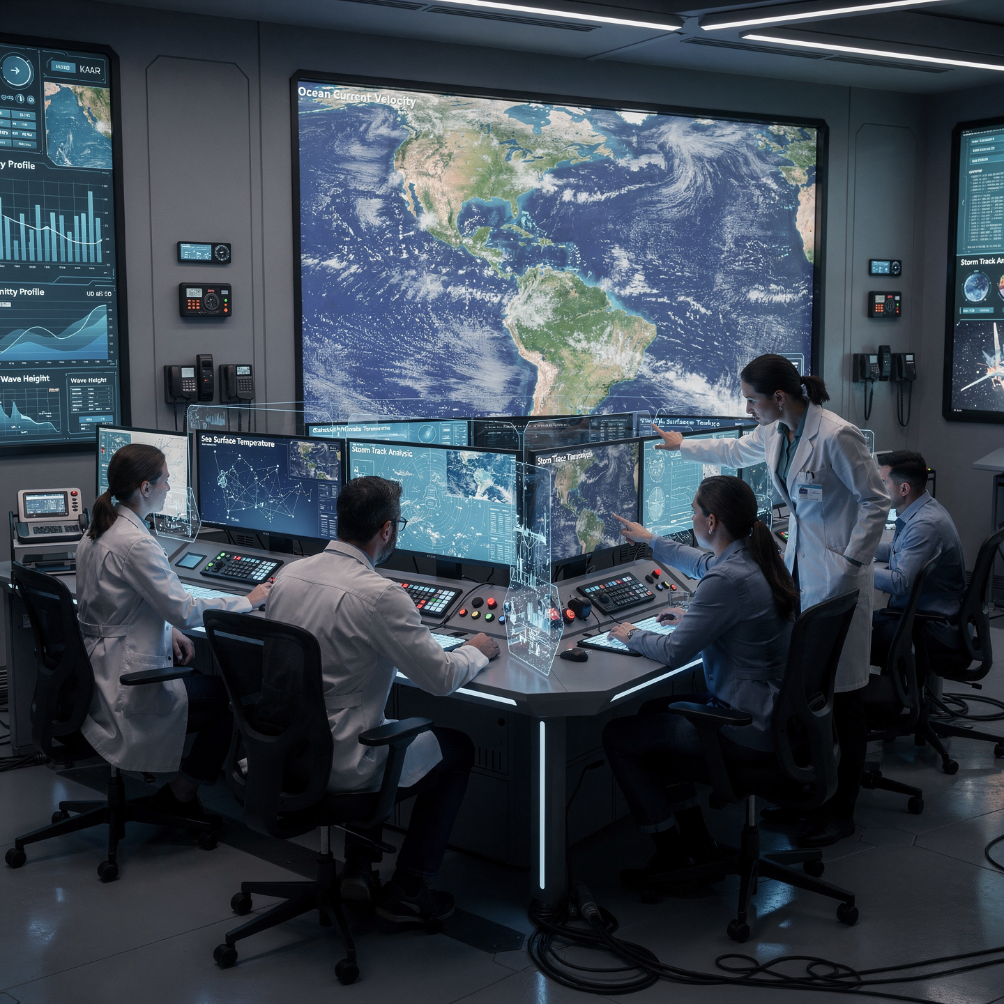
Modeling and predicting ocean dynamics:

Develop advanced numerical models, calibrated with satellite and *in situ* data, to simulate currents, temperature and salinity, allowing us to anticipate extreme events and their impact on coastal ecosystems.

Analyze and understand ocean-atmosphere interactions:

Understanding the mechanisms of energy, mass, and momentum transfer between the ocean and the atmosphere, and their impact on weather and climate prediction.

Applying remote sensing to study the oceans:

“To identify and analyze patterns of sea surface temperature, ocean currents, and chlorophyll concentration using satellite data, in order to understand ocean dynamics and their impact on climate and marine life.”

Develop new methodologies for spatial oceanographic analysis:

Implement advanced geostatistical models to interpolate and predict oceanographic variables in areas with scattered data, integrating remote sensing and in situ data to improve the spatial and temporal resolution of the analyses.

Managing space oceanographic research projects:

“Plan and execute sampling campaigns, ensuring data integrity and compliance with scientific protocols.”

Interpreting satellite data to understand ocean processes:

Identify patterns of sea surface temperature, currents, and primary productivity to infer ocean dynamics and their impact on climate and marine life.

Study plan – Modules

  1. Fundamentals of satellite remote sensing: physical principles, active and passive sensors, electromagnetic spectra, and spatial-temporal resolution
  2. Advanced satellite data processing: atmospheric correction, radiometric calibration, supervised and unsupervised segmentation and classification
  3. Detection and monitoring of oceanographic parameters: sea surface temperature, chlorophyll, turbidity, ocean color, and phytoplankton concentration
  4. Application of multispectral and hyperspectral analysis algorithms for the identification and evaluation of marine habitats and coastal biomes
  5. Integration of satellite data with hydrodynamic models for understanding coastal dynamics and transport and dispersion processes
  6. Temporal and spatial monitoring of extreme marine events: red tides, upwelling, river discharge, and coastal pollution
  7. Development and use of Systems of Geographic Information Systems (GIS) for the integrated management of marine protected areas and vulnerable coastal zones

    Multi-source analysis of satellite sensors (MODIS, Sentinel, VIIRS, Landsat) for assessing marine biodiversity and productivity

    Applications in integrated coastal management: land-use planning, environmental impact mitigation, and conservation policies based on satellite evidence

    Practical case studies: implementation and evaluation of coastal management plans using remote sensing in areas of high ecological and socioeconomic value

  1. Fundamentals of Multispectral Remote Sensing: Physical Principles, Radiative Interaction, and Satellite Data Acquisition
  2. Oceanic Satellite Sensors: Technical Characteristics, Spectral Bands, and Spatial and Temporal Resolution
  3. Radiometric and Atmospheric Correction: Advanced Methods for Mitigating Distortions in Multispectral Images
  4. Digital Image Processing: Algorithms for Filtering, Enhancement, Classification, and Spectral Segmentation
  5. Oceanographic Biophysical Modeling: Multispectral Correlation with Parameters such as Chlorophyll, Suspended Matter, and Surface Temperature
  6. Integration of Multispectral Data with Hydrodynamic Models for Real-Time Ocean Forecasting and Monitoring
  7. Applications in Extreme Event Detection: Multitemporal Analysis for Monitoring Red Tides, Spills, and Flow sedimentary
  8. Implementation of early warning systems based on automated multispectral processing

    Specialized software and GIS platforms for multispectral satellite data analysis and visualization

    Case studies and validation studies: in-situ calibration and verification with traditional oceanographic data

  1. Fundamentals of satellite remote sensing: physical principles of remote sensing, radiative interaction, and active and passive sensors
  2. Electromagnetic spectra applied to oceanography: analysis of visible, infrared, and microwave spectral bands for the identification of marine parameters
  3. Satellite platforms for marine monitoring: technical characteristics of Earth observation satellites, polar vs. geostationary orbits, and their applicability in coastal and oceanic ecosystems
  4. Advanced processing of multispectral images: radiometric and geometric calibration techniques, atmospheric correction, and fusion of multisensor data to increase spatial and spectral resolution
  5. Models and algorithms for information extraction: detection of chlorophyll, turbidity, sea surface temperature (SST), and biochemical composition derived from multispectral analysis
  6. Integration of satellite data with systems GIS: Generation of high-precision thematic maps for the assessment and monitoring of marine ecosystems and vulnerable coastal zones.

    Detection and monitoring of critical environmental events: Identification and temporal analysis of harmful algal blooms, oil spills, and thermal disturbances in coral ecosystems using satellite techniques.

    Application of artificial intelligence and machine learning: Automatic classification and prediction of ecological states using multi-temporal satellite image datasets.

    Monitoring of coastal dynamics and morphodynamic changes: Use of multispectral sensors and radar to assess erosion, sedimentation, and coastal processes under environmental stress.

    Practical case studies: Implementation of advanced satellite methodologies in real-world marine management projects for sustainable decision-making in conservation and resource use.

  1. Theoretical foundations of multisensor fusion: optical principles, synthetic aperture radar (SAR), atmospheric LiDAR, and high-frequency (HF) radars
  2. Advanced signal processing: algorithms for the spatial and temporal integration of heterogeneous data from remote sensors
  3. Radiometric and geometric calibration and correction on satellite and airborne platforms to ensure accuracy in data fusion
  4. Physical and statistical modeling of ocean variables from multisensor data: surface temperature, salinity, turbidity, and coastal current dynamics
  5. Implementation of artificial intelligence: deep learning and convolutional neural networks for automatic pattern extraction and classification in multisensor images
  6. Development of predictive models for extreme marine events: assessment and anticipation of storm surges, coastal storms, and hydrodynamic anomalies
  7. Integration
  8. Operational monitoring systems: real-time data flows, cloud computing platforms, and early warning systems in coastal management
  9. Advanced applications in integrated management: environmental zoning, marine resource planning, and anthropogenic impact assessment using combined datasets
  10. Real-world case studies and validation of predictive models with in-situ and satellite data: cross-calibration and uncertainty analysis
  11. International protocols and standards for the transmission, security, and storage of multisensor data related to space oceanography
  12. Multiplatform methodologies for sensor integration: polarimetric satellites, LiDAR drones, HF buoys, and ground-based coastal radar systems
  13. Computational optimization and parallel processing for the efficient handling of large volumes of information in real time
  14. Future perspectives: advances in hyperspectral sensors, explainable artificial intelligence (XAI), and their impact on sustainability and resilience
  15. coastal

  1. Physical and spectral principles of electromagnetic radiation in the multispectral range applied to oceanography
  2. Design and technical characteristics of satellite sensors: spectral, spatial, and temporal resolution, radiometric calibration, and in situ validation
  3. Satellite data processing: atmospheric correction, cloud detection and removal, and fusion of multispectral and panchromatic images
  4. Biophysical and biochemical models derived from multispectral sensors for estimating chlorophyll, suspended matter, and sea surface temperature
  5. Detection and monitoring of dynamic oceanographic phenomena: eddies, thermal fronts, upwelling zones, and sediment plumes using multispectral analysis
  6. Integration of satellite data with numerical and assimilation models for prediction and Simulation of complex ocean processes

    Advanced supervised and unsupervised classification techniques for marine habitat characterization and environmental change monitoring

    Operational applications: water quality monitoring, red tide prediction, assessment of anthropogenic impacts, and sustainable fisheries management

    Use of complementary platforms: combined use of active sensors (LIDAR, SAR radar) with passive multispectral sensors for multifactorial analysis

    Current and future challenges in oceanographic satellite technology: miniaturization, satellite constellations, and access to big data for real-time decision-making

  1. Fundamentals of space-based remote sensing applied to oceanography: physical principles, acquisition and processing of multispectral and hyperspectral satellite data
  2. Advanced remote sensing systems: synthetic aperture radar (SAR), satellite altimetry, thermal radiometry, and optical spectrometry for ocean monitoring
  3. Preprocessing algorithms: atmospheric correction, radiometric calibration, and georeferencing to ensure the quality and accuracy of oceanographic data
  4. Mathematical and numerical models in oceanography: fluid dynamics, current modeling, wave action, and sediment transport
  5. Integration of artificial intelligence and machine learning for predictive analysis: deep neural networks, supervised and unsupervised learning applied to oceanographic phenomena
  6. Development and validation of predictive models for the integrated management of marine ecosystems: climate change simulation, biodiversity assessment, and risk assessment Environmental

    Geographic Information Systems (GIS) and Oceanographic Data Visualization Platforms: Tools for Real-Time Decision Making

    Practical Applications in Coastal and Marine Management: Monitoring of Protected Areas, Sustainable Fishing, Natural Disaster Mitigation, and Pollution Control

    International Case Studies: Implementation of Advanced Remote Sensing and AI Modeling in Ocean Conservation and Responsible Use Programs

    Regulations, International Standards, and Protocols for Satellite Data and Their Application in Marine Public Policy

  1. Fundamentals of satellite remote sensing: physical principles of radiation-ocean interaction and satellite platforms orbiting the Earth
  2. Advanced instrumentation for marine observation: hyperspectral sensors, synthetic aperture radars (SAR), laser and multispectral altimeters
  3. Radiometric processing and correction of satellite images: atmospheric noise removal, cross-calibration, and precise georeferencing
  4. Advanced algorithms for detecting oceanographic parameters: surface temperature, chlorophyll concentration, turbidity, and surface currents
  5. Predictive modeling based on machine learning and deep learning for ecosystem dynamics: neural networks, spatial regression, and satellite time series
  6. Integration of in situ, satellite, and numerical modeling data for holistic assessment of marine ecosystems
  7. Analysis Spatiotemporal analysis for the early detection of anomalous phenomena: algal blooms, coral bleaching events, and point source pollution.

    Development and implementation of early warning systems for the sustainable management and resilience of marine reserves and coastal protected areas.

    Specialized GIS tools for the management and advanced visualization of oceanographic data and predictive results.

    Case studies applied to environmental management and sustainability: assessment of the impact of climate change and adaptive strategies based on remote sensing and modeling.

  1. Fundamentals and structure of multimodal satellite systems: orbits, constellations, and sensor types for ocean observation
  2. Principles of satellite data acquisition and processing applied to ocean monitoring: synthetic aperture radar (SAR), altimetry, spectroscopy, and passive sensors
  3. Design and integration of multimodal satellite platforms for the synergistic collection of physical, chemical, and biological variables of the ocean
  4. Advanced architectures for real-time data transmission and assembly: satellite communication protocols, multiple access, and latency reduction
  5. Introduction to artificial intelligence (AI) algorithms applied to space oceanography: supervised, unsupervised, and deep learning for the interpretation of multimodal data
  6. Development and training of predictive models based on convolutional neural networks (CNNs) and recurrent neural networks (RNN) and transformers for the early detection of extreme oceanographic phenomena

    Fusion of multisensory and multimodal data using AI techniques to improve spatial and temporal resolution in ocean monitoring

    Intelligent geospatial systems: integration of satellite data with numerical oceanographic models and in-situ data for early warning generation

    Implementation of real-time monitoring platforms: dashboard design, data flow automation, and advanced visualization

    Predictive management of extreme ocean events: tsunamis, tropical storms, anomalous currents, and upwelling phenomena

    Validation and calibration of hybrid satellite-AI models through field campaigns and automatic oceanographic stations

    Security, resilience, and redundancy protocols in satellite systems to ensure operational continuity in the event of failures or Interferences

  7. Regulatory and ethical aspects of using satellite technology and AI algorithms for ocean environmental monitoring

    Case studies: Implementation of multimodal systems and AI in international ocean surveillance and coastal risk management projects

    Future perspectives: Technological trends in smart satellites, edge computing, and machine learning for advanced space oceanography

  1. Fundamentals of Multispectral Satellite Remote Sensing: Physical Principles, Spectral Bands, and Spatial Resolution
  2. Advanced Technologies in Satellite Sensors: Comparison of Optical, Infrared, SAR Radar, and Hyperspectral Sensors
  3. Multisensor Data Integration: Fusion of Satellite, In-Situ, and Airborne Data for Improved Accuracy and Coverage
  4. Multispectral Image Processing: Radiometric and Atmospheric Correction, Calibration, Segmentation, and Feature Extraction
  5. Remote Sensing Applications in Environmental Monitoring: Detection of Chlorophyll, Sea Surface Temperature, Turbidity, and Pollutant Tracking
  6. Predictive Modeling in Oceanography: Fundamentals of Coupled Numerical Models for Oceanic and Atmospheric Dynamics
  7. Artificial Intelligence Implementation: Convolutional Neural Networks and Machine Learning
  8. In-depth analysis for automatic classification and detection in satellite data
  9. Decision support systems for coastal management: integration of multi-temporal data and spatial modeling for risk planning and mitigation
  10. Prediction and monitoring of extreme events: early warnings based on multivariate analysis and artificial intelligence applied to cyclones, storm surges, and coastal phenomena
  11. Advanced case studies: critical evaluation of international projects in satellite remote sensing for marine management and natural disaster response
  12. Software tools and technological platforms: use of GIS, ENVI, Google Earth Engine, and programming languages ​​oriented towards satellite analysis and predictive modeling
  13. Challenges and emerging trends in space oceanography: next-generation sensors, satellite big data, and automation in environmental monitoring
  1. Fundamentals of satellite remote sensing in oceanography: physical principles of data acquisition, passive and active sensors, spatial, temporal, and spectral resolution, radiometric calibration, and atmospheric correction
  2. Advanced satellite image processing: algorithms for detecting chlorophyll, sea surface temperature (SST), and suspended matter concentration; use of platforms such as Sentinel, MODIS, and VIIRS
  3. Multi-sensor data integration: fusion of optical information, synthetic aperture radar (SAR), and altimetry for multidimensional oceanographic characterization
  4. Predictive numerical modeling of marine dynamics: mathematical foundations, Navier-Stokes equations applied to geophysical fluids, hydrodynamic modeling, and coupling with satellite observational data
  5. Simulation and validation of marine ecosystem models using data Satellite data: modeling of primary productivity, biogeochemical cycles, and response to climate variability

    Geographic Information Systems (GIS) applied to space oceanography: management, spatial analysis, and advanced visualization of integrated ocean data for decision-making

    Methodologies for the assessment and sustainable management of marine ecosystems based on remote sensing and predictive modeling: ecological indicators, detection of vulnerable areas, and environmental impact analysis

    Implementation of technological platforms for real-time monitoring: integration of geostationary and polar satellites, coastal stations, and early warning systems

    Development of case studies and applied projects: design and execution of a final project integrating remote sensing and modeling for sustainable environmental management in marine protected areas

    Ethical, legal, and regulatory aspects in the use of satellite data and its application in public policies for marine conservation

Career prospects

“`html

  • Research Scientist: Development of oceanographic models, analysis of satellite data, publication of scientific articles.
  • Operational Oceanographer: Prediction of sea state, monitoring of extreme events, support for navigation and maritime activities.
  • Environmental Consultant: Assessment of the environmental impact of coastal and marine activities, design of mitigation measures.
  • Marine Resource Manager: Sustainable planning and management of ocean resources, development of marine policies.
  • Oceanographic Data Analyst: Processing and analysis of large volumes of oceanographic data, development of visualization tools.
  • Marine Remote Sensing Specialist: Application of remote sensing techniques for the study of the ocean, development of image processing algorithms.
  • Oceanographic Instrumentation Technician: Design, development, and maintenance of oceanographic measuring instruments; participation in measurement campaigns.
  • Environmental Educator: Dissemination of oceanographic knowledge; design of educational programs about the ocean and its conservation.

“`

Entry requirements

Academic/professional profile:

Bachelor’s degree in Nautical Science/Maritime Transport, Naval/Marine Engineering or a related qualification; or proven professional experience on the bridge/in operations.

Language proficiency:

Functional Maritime English (SMCP) recommended for simulations and technical materials.

Documentation:

Updated CV, copy of qualification or seaman’s book, national ID/passport, motivation letter.

Technical requirements (for online):

Device with camera/microphone, stable internet connection, monitor ≥ 24” recommended for ECDIS/Radar-ARPA.

Admissions process and dates

Online
application

(form + documents).

Academic review and interview

Admissions decision

Admissions decision

(+ scholarship offer if applicable).

Place reservation

(deposit) and enrolment.

Induction

(access to the virtual campus, calendars, simulator guides).

Scholarships and financial support

  • Satellite Data Analysis: Master the techniques for processing and analyzing oceanographic data obtained by satellite.
  • Oceanographic Modeling: Learn to develop and apply numerical models to simulate and predict ocean behavior.
  • Marine Remote Sensing: Delve into the use of remote sensors for studying key ocean variables such as temperature, salinity, and chlorophyll.
  • Climate Change and Oceans: Investigate the impact of climate change on marine ecosystems and ocean currents.
  • Practical Applications: Develop research projects and practical applications in areas such as fishing, navigation, and coastal management.
Boost your career with specialized training at the forefront of oceanography.

Testimonials

Frequently asked questions

The study of large-scale ocean processes using space technology, such as satellites.

Yes. The itinerary includes ECDIS/Radar-ARPA/BRM with harbor, ocean, fog, storm, and SAR scenarios.

Online with live sessions; hybrid option for simulator/practical placements through agreements.

It studies large-scale ocean processes using satellite technology, such as sea surface temperature, currents, sea height, and winds, to understand ocean dynamics and their interaction with the global climate.

Recommended functional SMCP. We offer support materials for standard phraseology.

Yes, with a relevant degree or experience in maritime/port operations. The admissions interview will confirm suitability.

Optional (3–6 months) through Companies & Collaborations and the Alumni Network.

Simulator practice (rubrics), defeat plans, SOPs, checklists, micro-tests and applied TFM.

A degree from Navalis Magna University + operational portfolio (tracks, SOPs, reports and KPIs) useful for audits and employment.

  1. Fundamentals of satellite remote sensing in oceanography: physical principles of data acquisition, passive and active sensors, spatial, temporal, and spectral resolution, radiometric calibration, and atmospheric correction
  2. Advanced satellite image processing: algorithms for detecting chlorophyll, sea surface temperature (SST), and suspended matter concentration; use of platforms such as Sentinel, MODIS, and VIIRS
  3. Multi-sensor data integration: fusion of optical information, synthetic aperture radar (SAR), and altimetry for multidimensional oceanographic characterization
  4. Predictive numerical modeling of marine dynamics: mathematical foundations, Navier-Stokes equations applied to geophysical fluids, hydrodynamic modeling, and coupling with satellite observational data
  5. Simulation and validation of marine ecosystem models using data Satellite data: modeling of primary productivity, biogeochemical cycles, and response to climate variability

    Geographic Information Systems (GIS) applied to space oceanography: management, spatial analysis, and advanced visualization of integrated ocean data for decision-making

    Methodologies for the assessment and sustainable management of marine ecosystems based on remote sensing and predictive modeling: ecological indicators, detection of vulnerable areas, and environmental impact analysis

    Implementation of technological platforms for real-time monitoring: integration of geostationary and polar satellites, coastal stations, and early warning systems

    Development of case studies and applied projects: design and execution of a final project integrating remote sensing and modeling for sustainable environmental management in marine protected areas

    Ethical, legal, and regulatory aspects in the use of satellite data and its application in public policies for marine conservation

Request information

  1. Complete the Application Form.

  2. Attach your CV/degree certificate (if you have it to hand).

  3. Indicate your preferred cohort (January/May/September) and whether you would like the hybrid option with simulator sessions.

    An academic advisor will contact you within 24–48 hours to guide you through the admission process, scholarships, and compatibility with your professional schedule.

Please enable JavaScript in your browser to complete this form.
Click or drag a file to this area to upload.

Faculty

0
    0
    Tu carrito
    Tu carrito esta vacíoRegresar a la tienda
    Scroll to Top