
Diploma in Satellite Ocean Observation
The Diploma in Satellite Ocean Observation Prepares you to obtain, process and interpret satellite data of the ocean. You will learn the physical principles of remote sensing and the sensors behind sea surface temperature, ocean c
Prior Knowledge Assessment
These are the skills this programme builds. Tick the ones you already have and we will tell you which part of the syllabus is really for you.
What is the Diploma in Satellite Ocean Observation?
The Diploma in Satellite Ocean Observation
Prepares you to obtain, process and interpret satellite data of the ocean. You will learn the physical principles of remote sensing and the sensors behind sea surface temperature, ocean colour, altimetry, wind and sea ice, as well as synthetic aperture radar. You will also learn to access products from Copernicus and other space agencies, process them with open tools and turn them into useful information for environmental monitoring, fisheries, shipping and coastal management.
Key advantages
- Leading open data: Work with products from Copernicus, ESA, NASA and NOAA.
- Every sensor type: Optical, infrared, microwave, altimetry and SAR radar.
- Free, open tools: Processing with open-source software and Python.
- Real applications: Oil spills, algal blooms, vessels, sea ice and coasts.
- Your own case study: A satellite analysis of a specific marine area.
Programme highlights
- Understand the sensors: Learn how ocean observation satellites take their measurements.
- Access the data: Download products from Copernicus and other agencies.
- Process imagery: Apply corrections, indices and classifications.
- Interpret the ocean: Analyse temperature, chlorophyll, sea level and waves.
- Boost your career: Open doors to space companies, consultancies and marine agencies.
- Train to view the ocean from space and turn those images into knowledge.
Programme Structure
The programme is structured in 8 modules, listed below in order of study.
Foundations of Ocean Remote Sensing
- The electromagnetic spectrum
- Radiation-ocean interaction
- Atmospheric effects
- Spatial, spectral and temporal resolution
- Orbits and revisit times
- Data processing levels
- Passive and active sensors
- Major space programmes
Sea Surface Temperature
- Infrared temperature measurement
- Microwave measurement
- Skin and mixed-layer temperature
- Cloud masking
- Level 3 and Level 4 products
- Thermal fronts
- Marine heatwaves
- Validation with buoys
Ocean Colour and Productivity
- Reflectance and water colour
- Chlorophyll and phytoplankton
- Open-ocean and coastal waters
- Atmospheric correction over the sea
- Turbidity and suspended sediment
- Harmful algal blooms
- Estimated primary production
- Ocean colour sensors
Altimetry, Wind and Waves
- Principles of radar altimetry
- Sea level and anomalies
- Geostrophic currents
- Mesoscale eddies
- Significant wave height
- Scatterometers and wind
- Coastal altimetry
- Recent altimetry missions
Synthetic Aperture Radar
- Principles of SAR
- Polarisation and backscatter
- Detecting oil spills
- Detecting vessels
- Waves and wind from SAR
- Sea ice with SAR
- Interferometry and coasts
- Limitations of SAR
Data Access and Processing
- Copernicus Marine Service
- The Copernicus and Sentinel ecosystem
- NASA and NOAA catalogues
- Satellite data formats
- Processing with open-source software
- Python for satellite imagery
- Cloud processing platforms
- Quality control
Marine Applications of Remote Sensing
- Pollution monitoring
- Support for fisheries
- Vessel monitoring
- Mapping coastal habitats
- Erosion and shoreline change
- Sea ice and polar regions
- Tracking climate change
- Integration with in situ data
Case Study: Satellite Analysis of a Marine Area
- Defining the area and objective
- Choosing sensors and products
- Downloading data
- Pre-processing
- Analysing variables
- Interpreting results
- Producing maps
- Final report
Study Time and Workload
800 hours of study, online and at your own pace. Move the slider to the hours a week you can really put in.
Graduates in marine science, geography, physics or engineering: who want to specialise in ocean remote sensing Environmental and public sector officers: who monitor the state of coasts and seas GIS analysts: who want to add marine satellite imagery to their skills Fisheries, aquaculture and shipping professionals: who use oceanographic information Researchers: who need satellite data for t
Academic direction and faculty
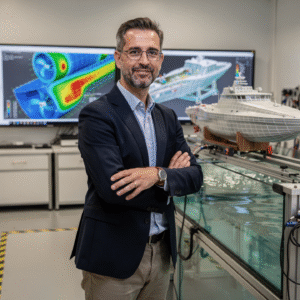
The teaching team at Navalis: working professionals who deliver and oversee the institute's programmes.




Student Reviews
Reviews collected and verified by Opynio, not written by us.
Learning Outcomes
- 01Understand ocean remote sensing
- 02Know the missions and sensors
- 03Access satellite products
- 04Process imagery
- 05Analyse ocean variables
- 06Apply the information
Career Opportunities
Entry Requirements
Admissions Process
No waiting for a phone call. If your documents are complete, you can pay in the same session.
Entry profile: A degree in marine science, environmental science, geography, physics, engineering or a related field; or professional experience in GIS, the environment or the marine sector. Language: A good working level of English to follow classes and materials. Technical requirements: A computer with a stable internet connection, an up-to-date browser and a webcam for live sessions and project presentations. Admissions process: Online application, profile review and a short interview with the academic team. We confirm your start date when you enquire.
Frequently Asked Questions
Leave your details and admissions will write back. If you already know this is the one, go straight to the application and pay in the same session.
