Diploma in Intelligent Navigation Systems

Why this certificate program?

The Diploma in Intelligent Navigation Systems

This program prepares you to lead the digital transformation in the maritime industry. Gain in-depth knowledge of emerging technologies and their practical application in route optimization, navigation safety, and efficient fleet management. Master the fundamentals of Artificial Intelligence, Machine Learning, IoT, and their integration with existing navigation systems, driving innovation and sustainability in the sector.

This program prepares you to lead the digital transformation in the maritime industry.

Differentiating Advantages

  • Practical Approach: Development of real-world projects and case studies to apply acquired knowledge.
  • Industry Experts: Learn from leading professionals in the implementation of intelligent navigation systems.
  • Cutting-Edge Tools: Access to software and simulation platforms to experiment with the latest technologies.
  • Professional Networking: Connect with other industry professionals and expand your network.
  • Online Flexibility: Study at your own pace and from anywhere, with access to multimedia content and discussion forums.
Sistemas

Diploma in Intelligent Navigation Systems

Availability: 1 in stock

Who is it aimed at?

  • Systems engineers, electronics engineers, and programmers looking to specialize in the development and implementation of autonomous navigation systems.
  • Professionals in the automotive, aerospace, and maritime industries interested in understanding and applying the latest intelligent navigation technologies.
  • Researchers and academics who want to deepen their knowledge of navigation algorithms, sensors, and control systems.
  • Technology companies and startups looking to innovate in the field of autonomous navigation and intelligent vehicles.
  • Graduate students in related fields seeking specialized and practical training in intelligent navigation systems.

Learning Flexibility
 Adapted to your pace: 24/7 accessible online content, active discussion forums, and personalized tutoring to answer your questions.

Sistemas

Objectives and competencies

Implement simultaneous localization and mapping (SLAM) algorithms:

“Adapting SLAM algorithms to specific environments, optimizing accuracy and robustness to sensory noise and computational limitations of the embedded system.”

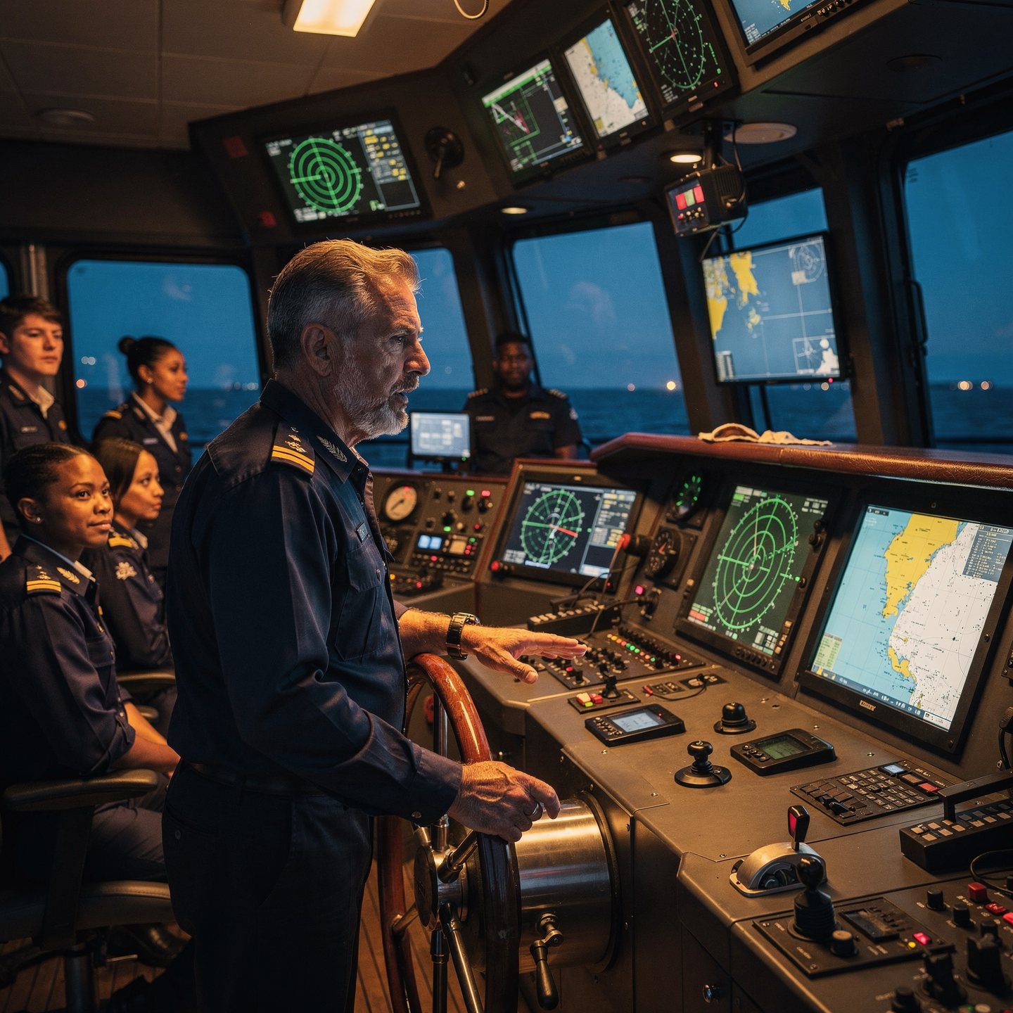
Design and integrate autonomous navigation systems:

Implement dynamic route planning adapted to the environment, optimizing fuel consumption and minimizing risks through fusion of data from multiple sensors and prediction of conditions.

Optimizing energy efficiency in navigation:

Plan the route by optimizing speed, considering currents, wind and sea conditions, minimizing fuel consumption and emissions.

Assessing and mitigating risks in complex navigation environments:

Analyze meteorological and oceanographic information to anticipate adverse conditions and adjust navigation planning, using prediction tools and effective communication with coastal stations.

Develop and validate predictive models for dynamic navigation:

Integrate sensor data, weather forecasts, and maritime traffic rules to optimize the route and anticipate risk situations, adapting the model in real time to changing conditions and validating its accuracy with historical data and simulations.

Managing cybersecurity in navigation systems:

Implement protection measures (firewall, antivirus, IDS) and incident response protocols, documenting procedures and reporting vulnerabilities to the competent authorities.

Curriculum - Modules

  1. Comprehensive Maritime Incident Management: protocols, roles, and chain of command for coordinated response
  2. Operational Planning and Execution: briefing, routes, weather windows, and go/no-go criteria
  3. Rapid Risk Assessment: criticality matrix, scene control, and decision-making under pressure
  4. Operational Communication: VHF/GMDSS, standardized reports, and inter-agency liaison
  5. Tactical Mobility and Safe Boarding: RHIB maneuvers, approach, mooring, and recovery
  6. Equipment and Technologies: PPE, signaling, satellite tracking, and field data logging
  7. Immediate Care of the Affected: primary assessment, hypothermia, trauma, and stabilization for evacuation
  8. Adverse Environmental Conditions: swell, Visibility, flows, and operational mitigation

    Simulation and training: critical scenarios, use of VR/AR, and exercises with performance metrics

    Documentation and continuous improvement: lessons learned, indicators (MTTA/MTTR), and SOP updates

  1. Introduction to Intelligent Systems Architecture: Layers, Components, and Data Flows.
  2. Sensor Fundamentals: Types, Characteristics, Accuracy, Calibration, and Maintenance.
  3. Motion and Orientation Sensors: IMU (Inertial Measurement Unit), Accelerometers, Gyroscopes, Magnetometers.
  4. Global Positioning Systems (GNSS): GPS, GLONASS, Galileo, BeiDou; Architectures and protocols.
  5. Indoor positioning: technologies (WiFi, Bluetooth, UWB, beacons), trilateration and fingerprinting methods.

    SLAM (Simultaneous Localization and Mapping): algorithms, sensors used, applications in robotics and augmented reality.

    Sensor fusion: filtering algorithms (Kalman, Particle Filter), integration of data from different sources.

    Wireless communication for sensors: protocols (Zigbee, LoRaWAN, NB-IoT), security, and power management.

    Sensor signal and data processing: filtering techniques, Fourier analysis, machine learning for pattern recognition.

    Applications of architecture, sensors, and smart positioning: smart cities, precision agriculture, logistics, healthcare, and security.

  1. Introduction to Sensor System Architecture: Types, characteristics, and applications.
  2. Fundamentals of Sensors for Environmental Perception: Physical principles, measurement ranges, and accuracies.
  3. Position and Orientation Sensors: IMUs, GNSS, encoders, odometry.
  4. Distance and Depth Sensors: LiDAR, stereo cameras, ultrasonic sensors, radar.
  5. Image Sensors: RGB cameras, hyperspectral cameras, thermal cameras.
  6. Sensor Signal Processing: Filtering, calibration, sensor fusion.
  7. 3D Environmental Modeling: Point clouds, meshes, volumetric models.
  8. Data Acquisition and Alignment Techniques: ICP, SLAM.
  9. Environmental Knowledge Representation: Semantic Maps, Scene Graphs.
  10. Environmental Modeling Applications: Robotics, Augmented Reality, Digital Twins.

  1. Introduction to Autonomous Navigation: History, Milestones, and Challenges
  2. Environmental Perception Sensors: Cameras (RGB, Depth), LiDAR, Radar, Ultrasound
  3. Image Processing: Object Detection, Semantic Segmentation, Pattern Recognition
  4. SLAM (Simultaneous Localization and Mapping): Algorithms, Variants, and Limitations
  5. Route Planning: Search Algorithms (A*, Dijkstra), Path Optimization
  6. Control and Actuation: Motion Models, PID Controllers, MPCs
  7. Localization and Odometry: GNSS, IMU, Encoders, Sensor Fusion
  8. Artificial Intelligence and Machine Learning in Autonomous Navigation: Learning by reinforcement, neural networks.
  9. Ethics and safety in autonomous navigation: legal considerations, liability, and failures.
  10. Software and hardware architectures for autonomous navigation systems.

  1. Introduction to Autonomous Navigation: History, Levels of Autonomy, and Applications
  2. Autonomous Systems Architecture: Perception, Planning, Control, and Actuation
  3. Navigation Sensors: Classification, Operating Principles, and Specifications
  4. Inertial Measurement Units (IMUs): Accelerometers, Gyroscopes, and Magnetometers
  5. Global Positioning Systems (GNSS): GPS, GLONASS, Galileo, and BeiDou
  6. LiDAR (Light Detection and Ranging): Principles, Types, Data Processing, and Applications
  7. Cameras: Monocular, Stereo, and RGB-D Vision; Image processing and computer vision

    Radar: principles, types, signal processing, and obstacle detection

    Visual odometry and SLAM (Simultaneous Localization and Mapping)

    Sensor fusion: Kalman filters, Bayesian networks, and advanced techniques

  1. System Architecture and Components: Structural design, materials, and subsystems (mechanical, electrical, electronic, and fluid) with selection and assembly criteria for marine environments
  2. Fundamentals and Principles of Operation: Physical and engineering foundations (thermodynamics, fluid mechanics, electricity, control, and materials) that explain performance and operating limits
  3. Safety and Environmental (SHE): Risk analysis, PPE, LOTO, hazardous atmospheres, spill and waste management, and emergency response plans
  4. Applicable Regulations and Standards: IMO/ISO/IEC requirements and local regulations;
  5. Conformance criteria, certification, and best practices for operation and maintenance
  6. Inspection, testing, and diagnostics: Visual/dimensional inspection, functional testing, data analysis, and predictive techniques (vibration, thermography, fluid analysis) to identify root causes
  7. Preventive and predictive maintenance: Hourly/cycle/seasonal plans, lubrication, adjustments, calibrations, consumable replacement, post-service verification, and operational reliability
  8. Instrumentation, tools, and metrology: Measuring and testing equipment, diagnostic software, calibration and traceability; selection criteria, safe use, and storage
  9. Onboard integration and interfaces: Mechanical, electrical, fluid, and data compatibility; Sealing and watertightness, EMC/EMI, corrosion protection, and interoperability testing.

    Quality, acceptance testing, and commissioning: process and materials control, FAT/SAT, bench and sea trials, go/no-go criteria, and evidence documentation.

    Technical documentation and integrated practice: logs, checklists, reports, and a complete case study (safety → diagnosis → intervention → verification → report) applicable to any system.

  1. Introduction to Environment Architecture: Basic Concepts and Levels of Abstraction
  2. Proximity Sensors: Types, Operation, Calibration, and Applications
  3. Vision Sensors: Cameras, LiDAR, Radar – Principles and Limitations
  4. Sensor Signal Processing: Filtering, Noise Reduction, and Sensor Fusion
  5. 3D Environment Modeling: Reconstruction, Representation, and Data Formats
  6. SLAM (Simultaneous Localization and Mapping): Algorithms and Challenges
  7. Semantic Mapping: Object Classification, Anomaly Detection, and Reasoning
  8. Environment Simulation: Generating Virtual Worlds for Testing and Validation
  9. Data Integration and Platforms: ROS, middleware, and frameworks
  10. Ethics and Privacy in Environmental Data Capture and Modeling

Career opportunities

  • Navigation Software Developer: Design and programming of autonomous and assisted navigation systems.
  • Test and Validation Engineer: Verification and certification of the safety and reliability of navigation systems.
  • Systems Integration Specialist: Implementation and configuration of navigation systems in land, air, and sea vehicles.
  • Intelligent Navigation Consultant: Advising companies and organizations on the adoption of advanced navigation technologies.
  • Robotics and Autonomous Vehicle Researcher: Development of navigation algorithms and techniques for robots and autonomous vehicles.
  • Navigation Data Analyst: Processing and analysis of navigation data for route optimization and safety improvement.
  • Navigation Project Manager: Planning and management of related projects with the development and implementation of intelligent navigation systems.

    Navigation Safety Specialist: Assessment and mitigation of risks related to the safety of autonomous navigation systems.

    “`

Admission requirements

Academic/professional profile:

Degree/Bachelor's degree in Nautical Science/Maritime Transport, Naval/Marine Engineering, or a related field; or proven professional experience in bridge/operations.

Language proficiency:

Recommended functional maritime English (SMCP) for simulations and technical materials.

Documentation:

Updated resume, copy of degree or seaman's book, ID card/passport, letter of motivation.

Technical requirements (for online):

Equipment with camera/microphone, stable connection, ≥ 24” monitor recommended for ECDIS/Radar-ARPA.

Admission process and dates

1. Online
application

(form + documents).

2. Academic review and interview

(profile/objectives/schedule compatibility).

3. Admission decision

(+ scholarship proposal if applicable).

4. Reservation of place

(deposit) and registration.

5. Induction

(access to campus, calendars, simulator guides).

Scholarships and grants

  • Cutting-edge Navigation: Master artificial intelligence algorithms applied to autonomous navigation.
  • Sensors and Perception: Learn to integrate and optimize LiDAR, radar, and cameras for accurate environmental perception.
  • Planning and Control: Develop route planning and predictive control strategies for autonomous systems.
  • Simulation and Testing: Use advanced simulation tools to validate and optimize system performance.
  • Practical Applications: Explore case studies in autonomous vehicles, drones, and marine robotics.
Boost your career in the field of autonomous navigation and leads the next generation of intelligent systems.

Testimonials

Frequently asked questions

Systems that use artificial intelligence, such as route planning algorithms, autonomous control systems, sensor data processing (GPS, LiDAR, cameras) and machine learning to optimize navigation in different environments.

Yes. The itinerary includes ECDIS/Radar-ARPA/BRM with harbor, ocean, fog, storm, and SAR scenarios.

Online with live sessions; hybrid option for simulator/practical placements through agreements.

Intelligent navigation systems, including technologies such as GPS, GLONASS, Galileo, inertial positioning, SLAM, machine vision, sensors, route planning, and control algorithms.

Recommended functional SMCP. We offer support materials for standard phraseology.

Yes, with a relevant degree or experience in maritime/port operations. The admissions interview will confirm suitability.

Optional (3–6 months) through Companies & Collaborations and the Alumni Network.

Simulator practice (rubrics), defeat plans, SOPs, checklists, micro-tests and applied TFM.

A degree from Navalis Magna University + operational portfolio (tracks, SOPs, reports and KPIs) useful for audits and employment.

  1. Introduction to Mobile Robotics and Autonomous Navigation
  2. Sensors: Types, characteristics, and operating principles (cameras, LiDAR, IMU, GPS)
  3. Environmental Perception: Acquisition and preprocessing of sensor data
  4. Environmental Representation: Occupancy maps, feature maps, and SLAM
  5. Localization: Estimation of the robot’s position and orientation in the environment
  6. Pathway Planning: Search algorithms (A*, Dijkstra) and reactive planning
  7. Motion Control: Kinematic and dynamic modeling of the robot
  8. Simulation and Prototyping: Simulation tools (ROS, Gazebo)
  9. Fusion Sensory integration: Integrating data from multiple sensors to improve accuracy

    Current challenges and trends in autonomous navigation

Request information

  1. Complete the Application Form.

  2. Attach your CV/degree certificate (if you have it to hand).

  3. Indicate your preferred cohort (January/May/September) and whether you would like the hybrid option with simulator sessions.

    An academic advisor will contact you within 24–48 hours to guide you through the admission process, scholarships, and compatibility with your professional schedule.

Please enable JavaScript in your browser to complete this form.
Click or drag a file to this area to upload.

Faculty

0
    0
    Tu carrito
    Tu carrito esta vacíoRegresar a la tienda
    Scroll to Top