Master’s Degree in Nautical Meteorology and Applied Oceanography

Why this master’s programme?

The Master’s Degree in Nautical Meteorology and Applied Oceanography

This program provides you with a deep understanding of the atmospheric and oceanic phenomena that impact navigation and maritime operations. Learn to interpret meteorological and oceanographic data, predict marine conditions, and optimize routes for safety and efficiency. This program combines advanced theory with state-of-the-art modeling and simulation tools, giving you practical skills for informed decision-making in the maritime environment.

Key Advantages

  • Analysis and Prediction: Master data analysis techniques and predictive models for meteorology and oceanography.
  • Safe and Efficient Navigation: Learn to apply meteorological and oceanographic knowledge to optimize routes and avoid risks.
  • Cutting-Edge Tools: Use industry-leading software and modeling tools.
  • Practical Applications: Develop real-world projects and case studies to solidify your learning.
  • Industry Experts: Learn by professionals with extensive experience in nautical meteorology and oceanography.

Master’s Degree in Nautical Meteorology and Applied Oceanography

Availability: 1 in stock

Who is it aimed at?

  • Merchant Navy officers and captains seeking to optimize route planning, navigational decision-making, and maritime safety in adverse weather conditions.
  • Maritime consultants and technicians requiring specialized knowledge in marine meteorology and oceanography for risk assessment, project management, and operational optimization.
  • Fishing and aquaculture professionals interested in improving the efficiency and sustainability of their activities through the use of accurate meteorological and oceanographic information.
  • Coastal engineers and port managers needing to understand oceanographic processes for the design, construction, and maintenance of resilient maritime infrastructure.
  • Graduates in Marine Science, Oceanography, Physics, or related fields For professionals seeking advanced specialization with practical applications in the maritime sector and coastal management.

    Flexibility for your professional development
    Adapted for working professionals: flexible online format, 24/7 access to learning resources, and personalized tutoring for learning at your own pace.

Objectives and skills

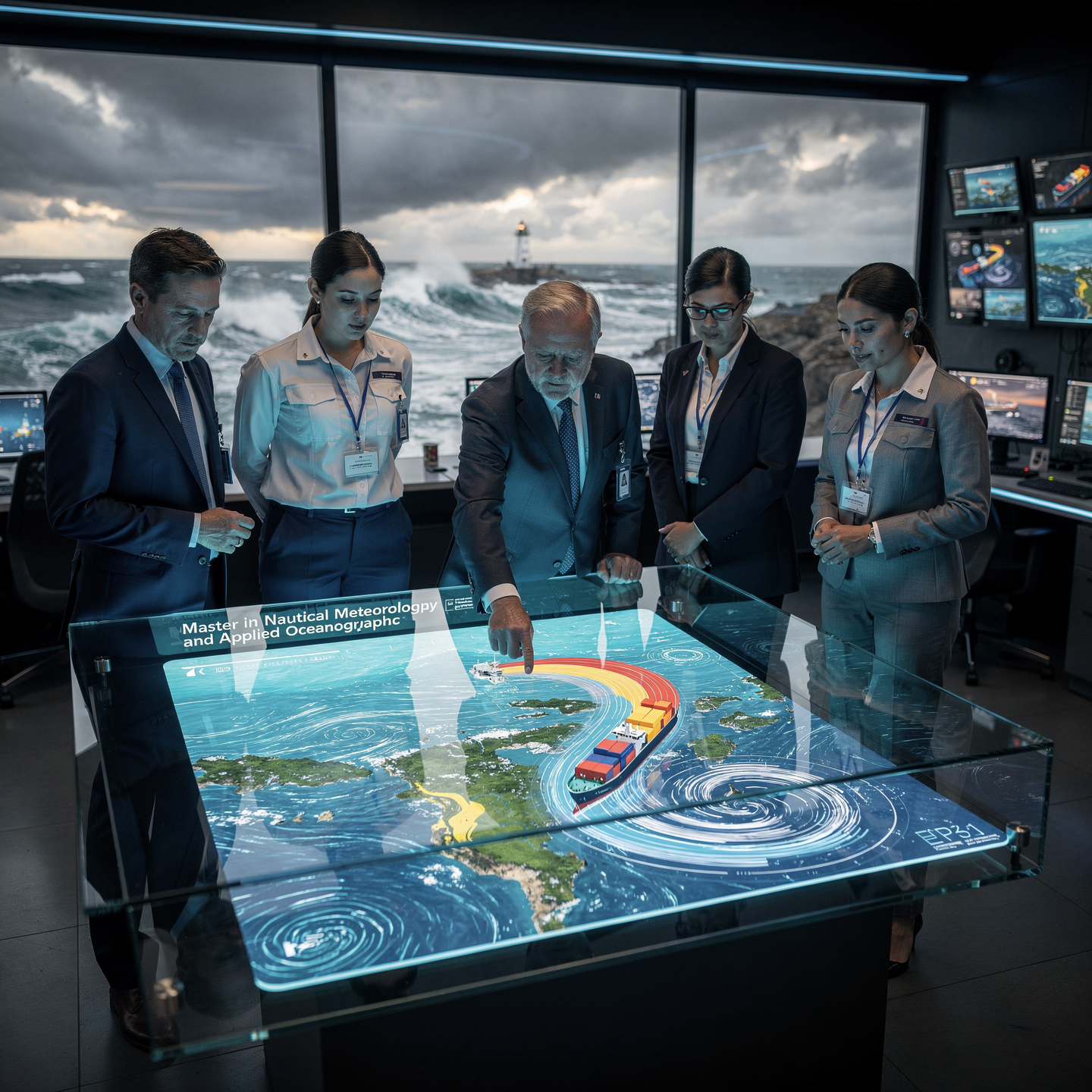
Interpreting and forecasting marine weather conditions:

Analyze data from buoys, satellites and numerical models to anticipate the state of the sea (waves, currents, wind) and its impact on navigation.

Managing ocean and coastal resources sustainably:

Implement climate change mitigation and adaptation strategies in coastal areas, considering the vulnerability of ecosystems and local communities.

Optimizing maritime operations through oceanographic analysis:

“Interpreting oceanographic data (currents, tides, waves) to optimize routes, reduce consumption and avoid risks, communicating efficiently to the crew and managing uncertainty.”

Develop predictive models for navigation and maritime safety:

Integrate AIS, meteorological and vessel sensor data to predict trajectories, collision risks and optimize routes, improving decision-making and safety.

Assessing risks and vulnerabilities in maritime environments:

“Identify threats (piracy, adverse weather, technical failures), analyze probability and impact, and implement effective preventive/corrective measures.”

Leading research projects in nautical meteorology and oceanography:

“To define clear objectives, manage resources efficiently, and communicate results with scientific rigor, ensuring the relevance and applicability of the research for the safety and efficiency of navigation.”

Study plan – Modules

  1. Fundamentals of atmospheric dynamics: pressure, temperature, humidity, and their interactions in the formation of marine weather systems
  2. Mechanisms of generation and evolution of high- and low-pressure systems: analysis of cyclonic and anticyclonic vortices in oceanic environments
  3. Global and regional atmospheric circulation: effects of the thermal gradient and Earth’s rotation on maritime wind patterns
  4. Ocean-atmosphere interaction: heat, humidity, and momentum transfer, with emphasis on its impact on navigation conditions
  5. Formation and behavior of coastal and local winds: sea breezes, katabatic and anabatic winds in port areas and estuaries
  6. Wave dynamics and their relationship with wind direction and speed, spectral analysis, and predictive models applied to nautical safety
  7. Advanced study of ocean currents: forces
  8. Driving forces, thermohaline and geostrophic balances, with practical applications for route planning
  9. Extreme weather phenomena in maritime zones: tropical cyclones, severe storms, and their detection using weather radars and oceanographic satellites
  10. Numerical atmospheric and oceanic modeling: interpretation of outputs and tools for predicting weather conditions applied to navigation
  11. Practical applications in navigation: integration of atmospheric and oceanic data for route optimization, risk minimization, and efficient energy consumption
  1. Fundamentals of numerical modeling in marine meteorology: Navier-Stokes equations, geophysical fluid dynamics, and parameterization of atmospheric processes
  2. Remote sensing and acquisition of oceanographic and meteorological data: weather satellites, buoys, coastal radars, and in-situ observation systems
  3. Mesoscale and global atmospheric models applied to marine forecasting: WRF, COSMO, and coupled general circulation models
  4. Hydrodynamic models and atmosphere-ocean coupling: simulation of currents, tides, waves, and their impact on local meteorology
  5. Advanced data processing and assimilation algorithms: variational methods, Kalman filters, and machine learning techniques to improve predictive accuracy
  6. Simulation and evaluation of extreme weather events: cyclones, ocean storms, wind gusts, and their modeling for mitigation Risks
  7. Optimization of maritime routes through predictive modeling: analysis of meteorological and oceanographic variables for reducing time and energy consumption
  8. Specialized IT tools: implementation and management of modeling software, meteorological databases, and GIS platforms applied to navigation
  9. Integration of real-time data for operational decision-making: early warning systems and safety protocols based on predictions
  10. Case studies and simulation studies: detailed analysis of maritime incidents with the application of predictive models for continuous improvement in safety management
  1. Advanced Fundamentals of Atmospheric and Oceanic Dynamics: Circulation Structures, Energy Exchange, and Thermodynamic Processes Applied to Nautical Meteorology
  2. Atmospheric Numerical Modeling Techniques: Subgrid Parameterization, Discretization Schemes, and Navier-Stokes Equation Solving for Short- and Medium-Term Forecasting
  3. Simulation of Extreme Weather Phenomena: Tropical Cyclones, Polar Vortices, and Deep Convection Events in the Maritime Context
  4. Ocean Wave and Current Models: Integration of Hydrodynamic and Sediment Transport Models for Detailed Forecasting
  5. Data Assimilation in Predictive Systems: Incorporation of Satellite Observations, Oceanographic Buoys, and Weather Radars to Improve Forecast Accuracy
  6. Optimization of Maritime Routes Using Predictive Algorithms: Analysis of Meteorological Variables and Oceanographic methods to minimize risks and operating costs.

    Implementation of AI-based Decision Support Systems (DSS) to support safe navigation planning.

    Real-time simulation and forecasting: data integration into dynamic platforms for operational management and decision-making on the bridge.

    Uncertainty assessment and sensitivity analysis in predictive models applied to nautical meteorology and oceanography.

    Practical case studies: application of predictive models in real-world navigation situations under adverse conditions, meteorological emergencies, and optimization of long routes.

  1. Fundamentals of marine remote sensing: physical principles of remote data acquisition in oceanic and coastal environments
  2. Satellite technologies for meteorology and nautical oceanography: optical sensors, synthetic aperture radar (SAR), altimeters, and radiometers
  3. Advanced marine radar: coastal and shipboard radar systems, signal processing, filtering techniques, and image enhancement for wave and obstacle detection
  4. Oceanographic and meteorological buoy networks: design, instrumentation (pressure, temperature, salinity, and current sensors), real-time data transmission, and preventive maintenance
  5. Autonomous marine vehicles (AUVs and ASVs): platforms, integrated sensors, programmed routes, and oceanographic and atmospheric data collection
  6. Advanced operational data processing: algorithms for spectral analysis, spatial interpolation, cross-validation, and detection of Time series anomalies
  7. Multisensor integration: Fusion of satellite, radar, buoy, and autonomous vehicle data for the creation of highly accurate, real-time maritime situational models

    Calibration and validation systems: Empirical and theoretical methods to ensure data accuracy and reliability, use of measurement campaigns and reference standards

    Practical applications in safe navigation: Data interpretation for predicting adverse weather events, dangerous swells, and coastal currents

    International regulations and standards on remote sensing and oceanographic data: Compliance in collection, transmission, and use in maritime operations

  1. Advanced Fundamentals of Atmospheric and Oceanic Dynamics: Physical Principles, Navier-Stokes Equations, and Applied Numerical Models
  2. Remote Sensing and Remote Sensors: Interpretation of Satellite Data, Weather Radar, and LiDAR Systems for Real-Time Maritime Monitoring
  3. Integrated Predictive Models: Coupling Meteorological and Oceanographic Models for Anticipation of Extreme Events and Critical Operating Conditions
  4. Processing and Analysis of Environmental Big Data: Use of Artificial Intelligence and Machine Learning for Forecast Optimization and Strategic Decision-Making
  5. Tidal and Current Dynamics: Advanced Harmonic Analysis, Atmospheric Interaction, and Effects on Navigation Routes and Port Maneuvers
  6. Meteorological and Oceanographic Risk Assessment: Hazard Identification, Risk Mapping, and Mitigation Protocols for Maritime Operations
  7. Integration of Oceanographic and Meteorological systems for maritime management platforms: ECDIS, AIS, and early warning systems

    Advanced methodologies for strategic decision-making: multi-criteria analysis, scenario simulations, and crisis management in navigation and maritime exploitation

    International regulations and operational protocols related to meteorology and oceanography: SOLAS, IMO, and IMO guidelines for maritime safety

    Practical case studies: interpretation and application of meteorological and oceanographic data in real-world navigation, research, and marine resource exploitation operations

  1. Physical and mathematical foundations of the predictive model: Navier-Stokes equations, geophysical fluid dynamics, and radiative transfer
  2. Ingestion and processing of meteorological and oceanographic data: satellite sensors, oceanographic buoys, Doppler radar, and coastal stations
  3. Numerical data assimilation for model initialization: real-time data analysis and fusion techniques
  4. Coupled atmospheric models: WRF, COSMO, and ECMWF applied at local, regional, and global scales
  5. Advanced oceanographic simulation: modeling of currents, tides, waves, and thermohaline processes
  6. Optimization of shipping routes using predictive algorithms: safety criteria, energy efficiency, and emissions reduction
  7. Interpretation and validation of forecasts: statistical techniques, error analysis, and cross-checking with on-site observations
  8. Integration of early warning systems for extreme phenomena: storms, cyclones, storm surges, and anomalous events

    Adaptation of predictive models to variable conditions in coastal and high seas navigation, including port areas of influence

    Practical application: development of software and digital tools for real-time visualization, monitoring, and decision-making

  1. Fundamentals of numerical modeling applied to meteorology and marine oceanography: basic equations of fluid dynamics, atmospheric and oceanic force balance
  2. Integration of atmospheric and oceanic models: bidirectional coupling and feedback in simulations for coastal areas and the open ocean
  3. Real-time data assimilation: advanced methods for incorporating satellite observations, oceanographic buoys, weather stations, and marine radars into predictive models
  4. Configuration and calibration of hydrodynamic and atmospheric models: parameterization of subscale processes, turbulence, and heat transfer at the air-sea interface
  5. Prediction of extreme weather events in marine environments: statistical and probabilistic analysis of storms, cyclones, extreme waves, and gusty winds
  6. Stochastic and machine learning models applied to weather forecasting and oceanographic analysis for route optimization

    Maritime risk assessment and mitigation: interpretation of model outputs for the safety of vessels, crew, and cargo

    Integration with electronic navigation and meteorological systems: ECDIS, radar, AIS, and incident systems to support real-time decision-making

    Advanced software and simulation platforms: professional use of WRF, ROMS, SWAN, and other tools for the practical implementation of predictive models

    Case studies and design of customized predictive strategies for operations in ports, high-traffic areas, and areas with complex weather conditions

  1. Fundamentals of oceanographic sensors: operating principles, calibration, and maintenance of ADCPs, CTDs, fluorometers, and coastal radar
  2. Satellite observation networks: satellite types (polar, geostationary), SAR radars, altimetry, and multispectral remote sensing
  3. Implementation and management of oceanographic buoys: configuration, real-time data transmission, and integration into maritime monitoring networks
  4. Numerical models for marine weather prediction: characteristics, parameterization, data assimilation, and uncertainty assessment
  5. Integration of oceanographic and meteorological data: multilayered information fusion for improved forecasts and early warnings
  6. Platforms and systems for massive data processing: big data and machine learning applied to oceanography and nautical meteorology
  7. Advanced applications of drones and autonomous vehicles for data collection in Areas of difficult access
  8. Probabilistic analysis and risk management: statistical methods for modeling extreme events and their impact on navigation

    Geographic information systems (GIS) applied to maritime space management and safe route planning

    Case studies and practical simulations: interpretation and use of observational data for decision-making in operational situations

  1. Fundamentals of numerical modeling in oceanography and meteorology: Navier-Stokes equations, discretization methods, and solution schemes
  2. Coupled atmospheric models: WRF, COSMO, and their parameterizations for marine environments
  3. Applied ocean dynamics: simulation of currents, waves, and thermohaline using models such as ROMS and SWAN
  4. Integration of in-situ and satellite data for assimilation into predictive models: sensors, platforms, and correction algorithms
  5. Application of artificial intelligence and machine learning in advanced meteorological and oceanographic forecasting
  6. Advanced maritime early warning and risk management systems using comprehensive predictive modeling
  7. Remote technologies and onboard sensors: LIDAR, coastal radar, and smart buoys for real-time monitoring
  8. Optimization of nautical routes based on forecasts
  9. Detailed hydrometeorological and probabilistic analyses of critical variables

    Implementation of integrated platforms and decision support systems for safety and operational efficiency in ports and high-density maritime areas

    Practical case studies: predictive modeling applied to navigation scenarios under extreme conditions and mitigation of adverse events

  1. Fundamentals of Multiscale Predictive Modeling: Temporal and Spatial Scales in Meteorology and Nautical Oceanography
  2. Integration of Atmospheric and Oceanographic Models: Dynamic Coupling and Critical Parameters for Safe Navigation
  3. Advanced Analysis of Offshore Meteorological Data: Remote Sensors, Buoys, Satellites, and Coastal Stations
  4. Implementation of Hydrodynamic Prediction Systems: Currents, Waves, and Oceanographic Variability for Shipping Routes
  5. Optimization Algorithms for Planning Resilient Shipping Routes in the Face of Adverse Conditions
  6. Assessment of Meteorological and Oceanographic Risks Using Stochastic and Deterministic Models
  7. Development of Early Warning Systems for Extreme Events: Storms, Hurricane-Force Winds, and Storm Surges
  8. Application of Machine Learning Techniques for Real-Time Predictive Improvement of Conditions Maritime
  9. Data integration into GIS platforms and ECDIS systems for the visualization and continuous monitoring of planned routes
  10. Methodologies for the validation, verification, and calibration of models in real-world operational scenarios
  11. Assessment of the impact of climate variability on navigation and long-term adaptation strategies
  12. Simulation of “what-if” scenarios for decision-making in preventive planning and nautical emergency management
  13. Energy balance and calculation of optimized fuel consumption according to meteorological and oceanographic conditions
  14. Development of the final integrative report: analysis, interpretation, and professional presentation of multidisciplinary results
  15. Presentation and technical defense of the final work before an expert committee, promoting scientific rigor and operational applicability

Career prospects

“`html

  • Marine Weather Forecasting: Preparation of forecasts for nautical and port activities.
  • Operational Oceanographer: Analysis and modeling of oceanographic data for various applications.
  • Nautical Meteorology Consultant: Advising companies and organizations on issues related to marine weather.
  • Oceanographic Data Management: Processing and analysis of large volumes of oceanographic information.
  • Research and Development: Participation in research projects in meteorology and oceanography.
  • Numerical Modeling: Development and application of predictive models of sea and atmospheric conditions.
  • Marine Environmental Monitoring: Control and monitoring of marine water and atmospheric quality.
  • Risk Assessment Coastal areas: Analysis of the vulnerability of coastal zones to extreme weather events.

    Navigation support: Provision of meteorological and oceanographic information for maritime safety.

    Teaching and outreach: Training and awareness-raising on topics related to nautical meteorology and oceanography.

    “`

Entry requirements

Academic/professional profile:

Bachelor’s degree in Nautical Science/Maritime Transport, Naval/Marine Engineering or a related qualification; or proven professional experience on the bridge/in operations.

Language proficiency:

Functional Maritime English (SMCP) recommended for simulations and technical materials.

Documentation:

Updated CV, copy of qualification or seaman’s book, national ID/passport, motivation letter.

Technical requirements (for online):

Device with camera/microphone, stable internet connection, monitor ≥ 24” recommended for ECDIS/Radar-ARPA.

Admissions process and dates

Online
application

(form + documents).

Academic review and interview

Admissions decision

Admissions decision

(+ scholarship offer if applicable).

Place reservation

(deposit) and enrolment.

Induction

(access to the virtual campus, calendars, simulator guides).

Scholarships and financial support

  • Advanced Meteorological Analysis: Master weather forecasting techniques and their impact on maritime navigation.
  • Applied Oceanography: Delve into the study of currents, tides, and ocean phenomena to optimize routes and operations.
  • Numerical Modeling: Learn to use specialized software to simulate meteorological and oceanographic scenarios.
  • Cartography and Geographic Information Systems (GIS): Visualize and analyze geospatial data for informed decision-making.
  • Practical Applications: Focused on navigation, fishing, marine renewable energy, and coastal management.
Boost your career with a master’s degree that will make you an expert in nautical meteorology and oceanography.

Testimonials

Frequently asked questions

Yes. The itinerary includes ECDIS/Radar-ARPA/BRM with harbor, ocean, fog, storm, and SAR scenarios.

Online with live sessions; hybrid option for simulator/practical placements through agreements.

Recommended functional SMCP. We offer support materials for standard phraseology.

Yes, with a relevant degree or experience in maritime/port operations. The admissions interview will confirm suitability.

Optional (3–6 months) through Companies & Collaborations and the Alumni Network.

Simulator practice (rubrics), defeat plans, SOPs, checklists, micro-tests and applied TFM.

A degree from Navalis Magna University + operational portfolio (tracks, SOPs, reports and KPIs) useful for audits and employment.

  1. Fundamentals of Multiscale Predictive Modeling: Temporal and Spatial Scales in Meteorology and Nautical Oceanography
  2. Integration of Atmospheric and Oceanographic Models: Dynamic Coupling and Critical Parameters for Safe Navigation
  3. Advanced Analysis of Offshore Meteorological Data: Remote Sensors, Buoys, Satellites, and Coastal Stations
  4. Implementation of Hydrodynamic Prediction Systems: Currents, Waves, and Oceanographic Variability for Shipping Routes
  5. Optimization Algorithms for Planning Resilient Shipping Routes in the Face of Adverse Conditions
  6. Assessment of Meteorological and Oceanographic Risks Using Stochastic and Deterministic Models
  7. Development of Early Warning Systems for Extreme Events: Storms, Hurricane-Force Winds, and Storm Surges
  8. Application of Machine Learning Techniques for Real-Time Predictive Improvement of Conditions Maritime
  9. Data integration into GIS platforms and ECDIS systems for the visualization and continuous monitoring of planned routes
  10. Methodologies for the validation, verification, and calibration of models in real-world operational scenarios
  11. Assessment of the impact of climate variability on navigation and long-term adaptation strategies
  12. Simulation of “what-if” scenarios for decision-making in preventive planning and nautical emergency management
  13. Energy balance and calculation of optimized fuel consumption according to meteorological and oceanographic conditions
  14. Development of the final integrative report: analysis, interpretation, and professional presentation of multidisciplinary results
  15. Presentation and technical defense of the final work before an expert committee, promoting scientific rigor and operational applicability

Request information

  1. Complete the Application Form.

  2. Attach your CV/degree certificate (if you have it to hand).

  3. Indicate your preferred cohort (January/May/September) and whether you would like the hybrid option with simulator sessions.

    An academic advisor will contact you within 24–48 hours to guide you through the admission process, scholarships, and compatibility with your professional schedule.

Please enable JavaScript in your browser to complete this form.
Click or drag a file to this area to upload.

Faculty

0
    0
    Tu carrito
    Tu carrito esta vacíoRegresar a la tienda
    Scroll to Top