Master’s Degree in Current and Tidal Observation

Why this master’s programme?

The Master in Current and Tidal Observation

This program provides you with a deep understanding of ocean dynamics. You will learn to analyze and model currents and tides using the latest observation technologies, from satellites and radar to in-situ sensors. This program will equip you to contribute to sustainable coastal management, safe maritime navigation, and the prediction of extreme events.

Differential Advantages

  • Cutting-edge tools: intensive use of software and platforms for oceanographic data analysis.
  • Practical approach: real-world projects and case studies to apply acquired knowledge.
  • Renowned experts: faculty with extensive experience in oceanographic research and practical applications.
  • Professional network: networking opportunities with companies and organizations in the maritime and environmental sectors.
  • Flexibility: option to study the master’s program full-time or part-time, adapted to your needs.
Observación

Master’s Degree in Current and Tidal Observation

Availability: 1 in stock

Who is it aimed at?

  • Oceanographers and physicists interested in numerical modeling, spectral analysis, and the prediction of currents and tides.
  • Coastal and port engineers seeking to optimize the design and management of maritime infrastructure, considering littoral dynamics.
  • Environmental consultants and natural resource managers who need to assess the impact of human activities on marine ecosystems.
  • Marine and renewable energy professionals who need to understand the variability of tidal currents for energy efficiency.
  • University researchers and professors seeking to delve deeper into state-of-the-art observational technologies and advanced analytical techniques.

Flexibility Academic:
 Adapted for professionals and full-time students: interactive online courses, flexible practical projects, and personalized tutoring.

Observación

Objectives and skills

Optimizing marine resource management:

“Plan navigation considering environmental factors (tides, currents, wind) and draft/height restrictions.”

Predicting and mitigating coastal risks:

“Analyze oceanographic and meteorological data to anticipate extreme events, implement infrastructure protection measures, and coordinate evacuations with local authorities.”

Design and implement early warning systems for extreme ocean events:

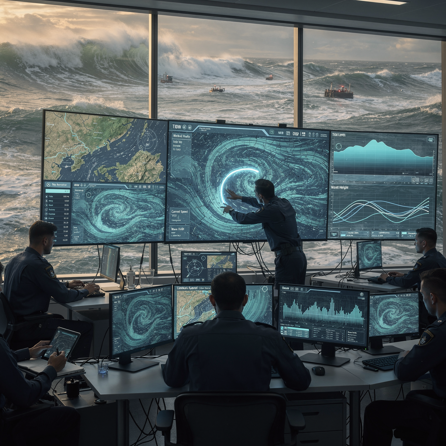
Integrate data from various sources (satellites, buoys, numerical models) and apply Machine Learning algorithms to identify anomalous patterns and predict extreme events accurately and in advance.

Accurately model ocean dynamics:

Implement advanced numerical models and calibrate key parameters (winds, tides, density) to simulate currents, waves, and temperatures, validating results with observational data and adjusting to predict ocean behavior under various conditions.

Advising on the planning and construction of resilient coastal infrastructure:

“Consider climate variability and sea level rise in the design, using sustainable and adaptable materials for the long term.”

Leading innovative oceanographic research projects:

“To foster multidisciplinary collaboration, managing resources and risks, in order to obtain high-impact scientific and technological results.”

Study plan – Modules

  1. Physical and mathematical foundations of ocean currents: fluid dynamics, Coriolis forces, and pressure gradients
  2. Tidal theory and analysis: harmonic constituents, frequency spectra, and multicomponent tidal analysis
  3. Numerical hydrodynamic modeling: Navier-Stokes equations, 2D and 3D hydrodynamic tidal models
  4. Implementation of numerical models: numerical methods, discretization and stabilization schemes
  5. Integration of observational data: data assimilation via buoys, tide gauge stations, and altimetric satellites
  6. Prediction and simulation models: short- and medium-term forecasting techniques based on digital models and machine learning
  7. Analysis of tidal-current interaction and its impact on coastal processes: sedimentation, erosion, and beach dynamics
  8. Case studies Applied applications: modeling of currents in estuaries, bays, and continental shelves

    Uncertainty assessment and model validation: metrics, calibration, and verification using experimental data

    Optimization and automation of observation and prediction systems: integration into oceanographic networks and early warning systems

  1. Fundamentals of remote sensing applied to oceanography: physical and technological principles
  2. Active and passive remote sensors: characteristics, types, and specific applications in current and tidal detection
  3. Satellite signal processing: advanced algorithms for oceanographic data extraction
  4. Spectral interpretation and multiband analysis: techniques to improve accuracy in dynamic monitoring
  5. Integration of LIDAR and RADAR systems for detailed mapping of coastal strips and recording of tidal variations
  6. Numerical models coupled with sensor data for real-time simulation of current patterns and tidal experiences
  7. Calibration and validation of sensors in the field: operating protocols and data quality control
  8. In-situ monitoring with complementary technologies: instrumented buoys, ADCP (Advanced Data Profiler) Acoustic Doppler Current) and coastal stations
  9. GIS tools and specialized software for three-dimensional visualization and temporal analysis of oceanographic data

    Practical applications and case studies: coastal risk management, current prediction for navigation, and environmental and port planning

  1. Fundamentals of numerical modeling: Navier-Stokes equations, hydrodynamic approximations, and boundary conditions applied to coastal and oceanic environments
  2. Hydrodynamic models for currents and tides: types (one-dimensional, two-dimensional, and three-dimensional), input parameters, and technical limitations
  3. Processes and methods for tidal simulation: harmonic analysis, tidal spectrum, and advanced time-decomposition techniques
  4. Modeling complex ocean currents: interaction between wind-driven flows, density gradients, and underwater topography
  5. Integration of observational data: assimilation of satellite data, oceanographic buoys, and remote sensors for improved forecasting
  6. Optimization and calibration of numerical models: parametric fitting techniques, validation by comparison with real data, and sensitivity analysis
  7. Advanced prediction using coupled models: hydrodynamics and Meteorology, incorporation of atmospheric forecasts for change scenarios

    Implementation of machine learning and artificial intelligence algorithms applied to current and tide prediction

    Operating systems for model execution: evaluation of computational performance, parallelization, and use of HPC (High Performance Computing)

    Advanced interpretation and visualization of results: generation of dynamic maps, time-series graphs, and decision-making tools for maritime planning

    Practical applications of numerical modeling: design of coastal infrastructure, estimation of navigational risks, and support for marine environmental management

    Development of protocols for continuous real-time model updates and prediction of extreme events such as storm surges, tsunamis, and storms

    International standards and regulations applicable to numerical modeling of currents and tides: data quality, certification, and validation

    Case studies: detailed analysis of models implemented in different regions of the world with emphasis on resolution and Forecast reliability

  8. Future trends in modeling and prediction: integration of hybrid models, marine IoT sensors, and autonomous observation systems

  1. Design and planning of oceanographic campaigns: scientific objectives, selection of study areas, and timing
  2. Advanced instrumentation for measuring currents and tides: ADCPs (Acoustic Doppler Current Profilers), tide gauges, pressure and temperature sensors, HF radars, and LIDAR systems
  3. Calibration and validation of sensors: metrological procedures, inter-instrument comparison techniques, and field adjustments
  4. Quality assurance and control of oceanographic data: anomaly detection, digital filtering, bias correction, and international standard protocols (IOOS, GOOS)
  5. Real-time observation networks: design, architecture, and communication protocols (TCP/IP, UDP, MQTT) for efficient and secure transmission of multi-spectral data
  6. Integration of autonomous and remote platforms: smart buoys, drifters, AUVs (autonomous underwater vehicles)
  7. Autonomous) and fixed coastal stations

    Marine data acquisition and management systems: SCADA software, georeferenced databases, and standardization using ISO 19115

    Operational numerical processing and modeling: data assimilation into hydrodynamic models for real-time prediction of currents and tidal variation

    Satellite and terrestrial communication protocols for real-time transmission: use of GPRS, VSAT, Iridium, and LoRaWAN networks

    Practical applications in maritime operations: safe navigation, port planning, mitigation of coastal impacts, and management of risks associated with tides and currents

  1. Fundamentals of physical oceanography: dynamics of ocean currents, tidal cycles, and hydrodynamic forces
  2. Principles and architecture of oceanographic systems: in situ sensors, buoys, HF radars, and autonomous platforms
  3. Acquisition and advanced processing of oceanographic data: calibration, validation, and time series correction
  4. Introduction to Big Data in marine sciences: characteristics, volume, variety, and velocity of oceanographic data
  5. Integration of heterogeneous sources: fusion of satellite data, numerical models, and coastal stations
  6. Predictive models of currents and tides: numerical analysis, hydrodynamic models, and statistical validation
  7. Machine learning methodologies applied to oceanography: supervised, unsupervised, and deep neural networks
  8. Model optimization using artificial intelligence: parameter tuning techniques, reduction
  9. error and generalization
  10. Data management and visualization platforms: use of GIS, interactive dashboards, and early warning systems
  11. Practical applications: extreme tide prediction, pollutant transport modeling, and support for maritime operations
  12. Current challenges and future perspectives: automation in observation, real-time integration, and adaptive models
  13. Case studies and integrative projects: design of a complete system for predictive optimization in a specific coastal environment
  1. Fundamentals of numerical modeling applied to current and tidal dynamics: Navier-Stokes equations, hydrodynamic approximations, and timescales
  2. Advanced hydrodynamic models: 2D and 3D models, fluid-sediment coupling, and multiscale models
  3. Implementation of numerical schemes: finite differences, finite volumes, and finite elements in coastal simulations
  4. Optimization and calibration of numerical models from observational data: statistical methodologies and data assimilation techniques
  5. Integration of in-situ and remote sensors for real-time monitoring: ADCPs, tide gauge buoys, coastal radar, and observation satellites
  6. Real-time data transmission protocols and systems: IoT architecture, satellite communications, and wireless sensor networks
  7. Dynamic processing and visualization platforms: specialized software for real-time analysis
  8. Real-time, automated alerts, and operational decision-making
  9. Advanced prediction and simulation techniques in extreme scenarios: analysis of meteorological tidal events, tsunamis, and critical coastal flows
  10. Implementation of artificial intelligence and machine learning in the predictive analysis of tidal patterns and coastal currents
  11. Case studies and practical applications in international projects: evaluation of results, continuous improvement, and technological standards
  1. Fundamentals of numerical modeling applied to currents and tides: Navier-Stokes equations, hydrodynamic governance equations, and principles of conservation of mass and energy
  2. Implementation of two-dimensional and three-dimensional hydrodynamic models: spatial and temporal discretization, advanced numerical schemes, and stabilization techniques
  3. Dynamics of ocean currents and tides: harmonic analysis, tidal interaction, and meteorological effects on coastal circulation
  4. Introduction and handling of remote sensing data for monitoring ocean parameters: optical sensors, longwave radar, satellite altimetry, and their advanced processing
  5. Digital processing of satellite and aerial images for the detection and tracking of current fronts, upwelling, and oceanographic parameters
  6. Integration and fusion of multiple datasets from satellite platforms, oceanographic buoys, and in-situ systems for
  7. Validation and calibration of numerical models
  8. Development and optimization of real-time monitoring systems using sensor networks integrated with IoT (Internet of Things) systems and Big Data platforms
  9. Application of Machine Learning techniques and predictive algorithms for the continuous improvement of accuracy in current and tide estimation
  10. Advanced data assimilation strategies: variational methods and Kalman filters in the dynamic updating of oceanographic numerical models
  11. Design and configuration of early warning systems for coastal risk management based on real-time current and tide forecasts
  12. Detailed study of the interaction between meteorological and oceanographic processes: coupled atmosphere-ocean modeling and its impact on regional hydrodynamics
  13. Computational optimization for high-resolution models: parallelization, use of GPUs, and supercomputing applied to complex marine forecasting systems
  14. Critical analysis of international case studies in tidal and current modeling and prediction with direct application to navigation, coastal engineering, and environmental management
  15. International regulations and technical standards for the implementation of prediction and continuous monitoring systems in maritime and port environments
  16. Methodologies for the preparation of specialized technical reports and advanced visualization of predictive results for decision-making in professional maritime environments
  1. Physical and mathematical foundations of coastal dynamics: Navier-Stokes equations, conservation of mass and momentum theorems, and their applications in coastal and estuarine environments
  2. Advanced hydrodynamic modeling: numerical techniques (finite element method, finite differences, and finite volumes) for simulating currents, tides, and freshwater and saltwater flows
  3. Integration of atmospheric and oceanographic forcing factors: winds, barometric pressure, and extreme weather events in coastal dynamics models
  4. Real-time monitoring systems: in-situ and remote sensors (ADCPs, tide gauges, weather stations, and satellites), data acquisition and processing for monitoring currents and tidal variability
  5. Spectral and harmonic analysis of tides: harmonic decomposition, tidal prediction, and model validation using historical time series and observational data
  6. Dynamics Sedimentary geomorphology and sediment transport: modeling of particle displacement, erosion and deposition processes, and their impact on coastal geomorphology

    Interaction between marine and river currents in estuaries: hydrodynamic configuration, stratification, mixing, and transport of nutrients and pollutants

    Applications in environmental management: assessment of the impact of coastal infrastructure, design of mitigation measures based on predictive modeling, and sustainable management of marine resources

    Maritime safety and coastal navigation: integration of hydrodynamic models with decision support systems for safe route planning and emergency management

    Case studies and applied simulations: applied analysis in critical areas, response to pollutant spills, and monitoring protocols for early warnings and rapid response

  1. Fundamental physical principles: fluid dynamics applied to ocean currents and tides, Coriolis forces, pressure gradients and their influence on water displacement
  2. Advanced mathematical and numerical models: Navier-Stokes equations, 2D and 3D hydrodynamic models, parameterization and simulation techniques for the accurate prediction of current and tidal patterns
  3. Real-time monitoring systems: in-situ sensors (ADCPs, tide gauges, oceanographic buoys), telemetry and data transmission technologies, sensor integrity and calibration
  4. Advanced signal processing and data analysis: digital filters, statistical methods, harmonic and spectral analysis for the interpretation of time series of currents and sea level
  5. Applied remote sensing technologies: use of altimetry satellites, synthetic aperture radar (SAR), and coastal radars for the remote detection of surface currents and variability
  6. Tide
  7. Systems and platform integration: development of integrated sensor networks, SCADA systems for control and monitoring, data interoperability with Geographic Information Systems (GIS)
  8. Predictive algorithms and artificial intelligence techniques: machine learning, neural networks, and adaptive models for continuous improvement in the prediction of tidal events and changes in currents
  9. Implementation of early warning systems: operational protocols, effective communication, and mitigation strategies based on real-time data and probabilistic predictions
  10. Regulatory aspects and international standards: IMO and ISO guidelines, data quality standards, and certification of oceanographic monitoring systems
  11. Case studies and professional applications: design and implementation of monitoring projects, analysis of real-world cases in highly complex coastal and marine areas, coastal risk management
  1. Advanced Fundamentals of Numerical Modeling Applied to Currents and Tides: Navier-Stokes Equations, Coastal and Oceanic Hydrodynamics, Scalability, and Spatiotemporal Resolution
  2. Remote Sensing in Operational Oceanography: Physical Principles, Active and Passive Sensors, Satellite Image Processing, Spectral Interpretation, and Specific Radiometric Calibration for Current and Tidal Phenomena
  3. Integration of In-Situ and Remote Data: Multi-Source Data Fusion Techniques, Cross-Validation, Time Series Correction, and Generation of Adaptive Hybrid Models in Real Time
  4. Big Data Applied to Oceanography: Data Architecture, Management of Large Volumes of Hydro-Oceanographic Information, Machine Learning Algorithms for Pattern Detection and Predictive Forecasting
  5. Development of the Integrated System: Modular Design, Human-Machine Interface (HMI), Communication and Synchronization Protocols between Sensors, Observation Stations, and Data Processing Centers
  6. Implementation of Models Real-time predictive analytics: data assimilation techniques, dynamic parameter tuning, uncertainty analysis, and automated generation of operational alerts.

    Computational optimization and use of HPC (High Performance Computing): calculation parallelization, latency reduction, and load balancing for simulations in complex coastal environments.

    Practical applications and case studies: extreme tide prediction, current monitoring for safe navigation, port planning, and coastal environmental management.

    Performance evaluation and system validation: metrics of accuracy, sensitivity, temporal and spatial consistency, and procedures for iterative post-implementation adjustments.

    Future perspectives and technological trends: artificial intelligence applied to oceanography, the Internet of Things (IoT) in marine observatories, and sustainable development based on real-time oceanographic data.

Career prospects

“`html

  • Oceanographer/Researcher: Analysis of oceanographic data, modeling of currents and tides, research on climate change and its impact on coastal areas.
  • Environmental Consultant: Environmental impact studies, modeling of pollutant dispersion, design of early warning systems for extreme events.
  • Coastal Resource Manager: Planning and management of coastal areas, development of climate change adaptation strategies, coastal risk assessment.
  • Coastal Engineer: Design and construction of maritime infrastructure, optimization of ports and navigation channels, coastal erosion protection.
  • Marine Data Analyst: Processing and analysis of satellite and oceanographic buoy data, development of visualization and prediction tools for currents and tides.
  • Renewable Energy Technician
  • Marine Engineering: Assessment of tidal and current energy potential, design and operation of marine power plants.

    Marine Cartographer/Hydrographer: Production of nautical charts and current maps, hydrographic surveys, management of marine geographic information.

    Lecturer/Trainer: Teaching at universities and research centers, training of professionals in the field of oceanography and coastal engineering.

    “`

Entry requirements

Academic/professional profile:

Bachelor’s degree in Nautical Science/Maritime Transport, Naval/Marine Engineering or a related qualification; or proven professional experience on the bridge/in operations.

Language proficiency:

Functional Maritime English (SMCP) recommended for simulations and technical materials.

Documentation:

Updated CV, copy of qualification or seaman’s book, national ID/passport, motivation letter.

Technical requirements (for online):

Device with camera/microphone, stable internet connection, monitor ≥ 24” recommended for ECDIS/Radar-ARPA.

Admissions process and dates

Online
application

(form + documents).

Academic review and interview

Admissions decision

Admissions decision

(+ scholarship offer if applicable).

Place reservation

(deposit) and enrolment.

Induction

(access to the virtual campus, calendars, simulator guides).

Scholarships and financial support

  • Advanced Analysis: Master the most innovative techniques for studying currents and tides.
  • Predictive Modeling: Develop skills in creating accurate models to anticipate their behavior.
  • Practical Applications: Learn to apply this knowledge in coastal engineering, navigation, and environmental management.
  • Industry Experts: Training delivered by leading professionals with real-world experience in the field.
  • Cutting-Edge Tools: Use specialized software and state-of-the-art technologies.
Impulsa your career with a master’s degree that prepares you for the challenges of the marine environment.

Testimonials

Frequently asked questions

Yes. The itinerary includes ECDIS/Radar-ARPA/BRM with harbor, ocean, fog, storm, and SAR scenarios.

Online with live sessions; hybrid option for simulator/practical placements through agreements.

Typically, a Master’s degree in Current and Tidal Observation includes both on-site physical observation and data analysis and numerical modeling, combining theory, fieldwork and computational tools.

Recommended functional SMCP. We offer support materials for standard phraseology.

Yes, with a relevant degree or experience in maritime/port operations. The admissions interview will confirm suitability.

Optional (3–6 months) through Companies & Collaborations and the Alumni Network.

Simulator practice (rubrics), defeat plans, SOPs, checklists, micro-tests and applied TFM.

A degree from Navalis Magna University + operational portfolio (tracks, SOPs, reports and KPIs) useful for audits and employment.

  1. Advanced Fundamentals of Numerical Modeling Applied to Currents and Tides: Navier-Stokes Equations, Coastal and Oceanic Hydrodynamics, Scalability, and Spatiotemporal Resolution
  2. Remote Sensing in Operational Oceanography: Physical Principles, Active and Passive Sensors, Satellite Image Processing, Spectral Interpretation, and Specific Radiometric Calibration for Current and Tidal Phenomena
  3. Integration of In-Situ and Remote Data: Multi-Source Data Fusion Techniques, Cross-Validation, Time Series Correction, and Generation of Adaptive Hybrid Models in Real Time
  4. Big Data Applied to Oceanography: Data Architecture, Management of Large Volumes of Hydro-Oceanographic Information, Machine Learning Algorithms for Pattern Detection and Predictive Forecasting
  5. Development of the Integrated System: Modular Design, Human-Machine Interface (HMI), Communication and Synchronization Protocols between Sensors, Observation Stations, and Data Processing Centers
  6. Implementation of Models Real-time predictive analytics: data assimilation techniques, dynamic parameter tuning, uncertainty analysis, and automated generation of operational alerts.

    Computational optimization and use of HPC (High Performance Computing): calculation parallelization, latency reduction, and load balancing for simulations in complex coastal environments.

    Practical applications and case studies: extreme tide prediction, current monitoring for safe navigation, port planning, and coastal environmental management.

    Performance evaluation and system validation: metrics of accuracy, sensitivity, temporal and spatial consistency, and procedures for iterative post-implementation adjustments.

    Future perspectives and technological trends: artificial intelligence applied to oceanography, the Internet of Things (IoT) in marine observatories, and sustainable development based on real-time oceanographic data.

Request information

  1. Complete the Application Form.

  2. Attach your CV/degree certificate (if you have it to hand).

  3. Indicate your preferred cohort (January/May/September) and whether you would like the hybrid option with simulator sessions.

    An academic advisor will contact you within 24–48 hours to guide you through the admission process, scholarships, and compatibility with your professional schedule.

Please enable JavaScript in your browser to complete this form.
Click or drag a file to this area to upload.

Faculty

0
    0
    Tu carrito
    Tu carrito esta vacíoRegresar a la tienda
    Scroll to Top