Diploma in Integrated Sea-Land Technology

Why this certificate program?

The Diploma in Integrated Sea-Land Technology

This program prepares you to lead the digital transformation in the maritime industry. Learn to optimize fleet management, improve operational efficiency, and ensure safety through the integration of cutting-edge technologies. This program provides you with the skills necessary to implement innovative solutions in communication, monitoring, data analysis, and process automation.

Differentiating Advantages

  • Systems Integration: Master the connection between onboard and shore-based platforms for unified management.
  • Data Analytics: Extract valuable information for strategic decision-making and continuous improvement.
  • Maritime Cybersecurity: Protect your systems and data against the growing cyber threats in the sector.
  • Process Automation: Optimize efficiency and reduce costs by implementing automated solutions.
  • Technology Trends: Stay ahead of the curve with the latest innovations in the maritime sector, such as IoT, AI, and blockchain.
Marketing

Diploma in Integrated Sea-Land Technology

Availability: 1 in stock

Who is it aimed at?

  • Maritime and port industry professionals seeking to optimize the management of operations through the integration of cutting-edge technologies.
  • Engineers, technicians, and consultants interested in developing and implementing innovative solutions for the automation and control of sea-to-shore processes.
  • Project managers and decision-makers who need a strategic vision on the latest trends in digitalization and connectivity in the maritime sector.
  • Logistics and supply chain specialists who want to improve the efficiency and traceability of operations through the use of integrated platforms.
  • Academics and researchers seeking to deepen their knowledge of emerging technologies and their application in the field Sea-land.

Flexibility for your development
 The diploma program offers a 100% online format with live classes and access to updated materials, allowing you to study at your own pace and from anywhere.

Marketing

Objectives and competencies

Optimize the comprehensive management of geospatial data:

Implement automated workflows for the validation, cleaning, and transformation of geospatial data, ensuring the quality and consistency of the information for its analysis and effective visualization.

Implementing technological solutions for the monitoring and sustainable management of marine and terrestrial resources:

Integrate remote sensing data (satellites, drones, buoys) with predictive models to optimize resource allocation and assess the impact of human activities.

Develop predictive models for the prevention and mitigation of coastal risks:

“Implement Machine Learning models (Regression, Classification, Time Series) with historical data of coastal events (storm surges, storms, erosion) to identify patterns and forecast impacts. Validate the models with real data and simulated scenarios, integrating them into early warning systems and coastal management plans.”

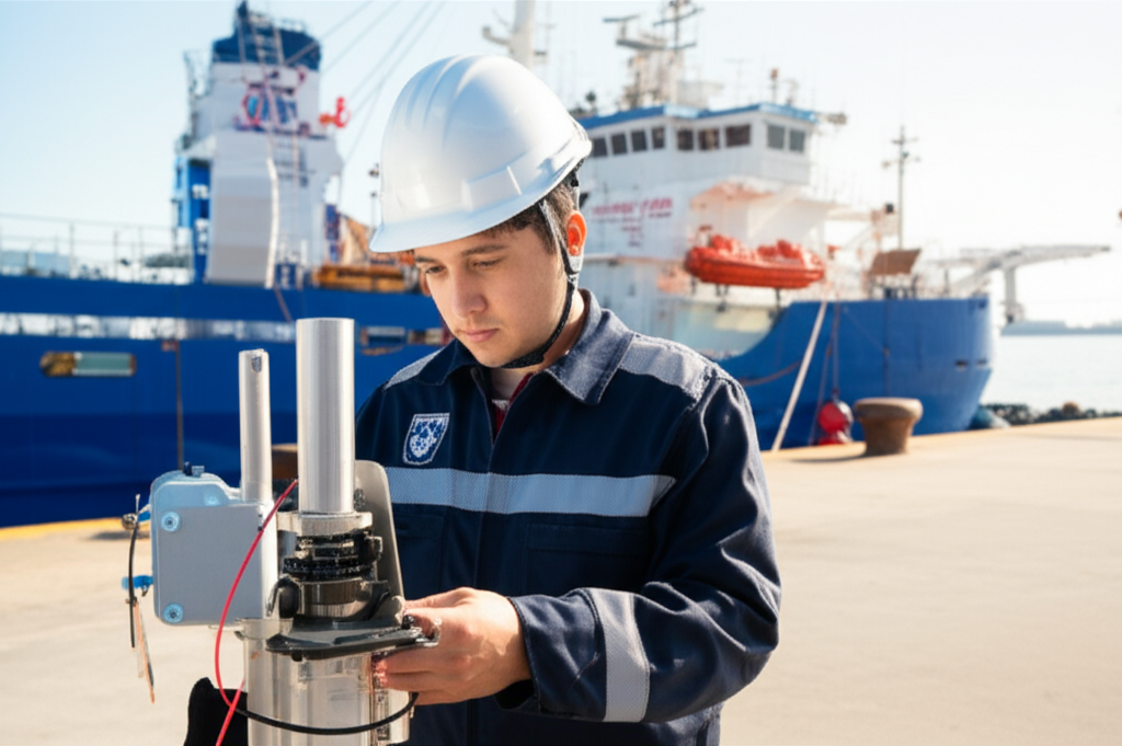
Design and implement efficient communication systems between maritime and land platforms:

Integrate satellite communication technologies, VHF/HF and IP networks, ensuring redundancy and cybersecurity, adapting protocols to international operating conditions and regulations.

Coordinate efficient logistics operations between ports, vessels, and land distribution centers:

“Optimize routes and transit times through logistics management software and constant communication with captains and distribution managers.”

Integrate advanced technologies to optimize the exploration and exploitation of marine and terrestrial energy resources:

Implement AI-based predictive models for production optimization and predictive maintenance of infrastructure.

Curriculum - Modules

  1. Comprehensive Maritime Incident Management: protocols, roles, and chain of command for coordinated response
  2. Operational Planning and Execution: briefing, routes, weather windows, and go/no-go criteria
  3. Rapid Risk Assessment: criticality matrix, scene control, and decision-making under pressure
  4. Operational Communication: VHF/GMDSS, standardized reports, and inter-agency liaison
  5. Tactical Mobility and Safe Boarding: RHIB maneuvers, approach, mooring, and recovery
  6. Equipment and Technologies: PPE, signaling, satellite tracking, and field data logging
  7. Immediate Care of the Affected: primary assessment, hypothermia, trauma, and stabilization for evacuation
  8. Adverse Environmental Conditions: swell, Visibility, flows, and operational mitigation

    Simulation and training: critical scenarios, use of VR/AR, and exercises with performance metrics

    Documentation and continuous improvement: lessons learned, indicators (MTTA/MTTR), and SOP updates

  1. Introduction to geospatial analysis: key concepts, types of geospatial data, coordinate systems.
  2. GIS software and analysis tools: QGIS, ArcGIS, Python libraries for geoanalysis.
  3. Acquisition and management of geospatial data: data sources (satellite, drones, sensors), geodatabases, file formats.
  4. Visualization of geospatial data: thematic mapping, map design, web mapping platforms.
  5. Exploratory analysis of geospatial data: spatial statistics, spatial autocorrelation, cluster detection.
  6. Geostatistical modeling: spatial interpolation, kriging, geostatistical simulation.
  7. Spatial regression models: generalized linear regression, models Spatial autoregressive models (SAR, CAR).
  8. Network analysis: flow models, path analysis, connectivity, and accessibility.
  9. Geospatial predictive modeling: machine learning for geospatial data, image classification, event prediction.
  10. Ethics and legal considerations in geospatial data analysis.

  1. Introduction to Data Integration in the Maritime Environment
  2. Maritime Sensors: Types, Characteristics, and Applications
  3. Maritime Connectivity: Technologies and Standards
  4. System Architectures for Maritime Data Integration
  5. Data Acquisition from Sensors: Protocols and Formats
  6. Sensor Data Processing and Filtering
  7. Data Transmission: Wireless and Satellite Networks
  8. Maritime Data Storage and Management
  9. Data Visualization: Tools and Techniques
  10. Data Security and Protection in Maritime Connectivity

  1. Introduction to Port Logistics: Actors, Processes, and Challenges
  2. Port Infrastructure: Types of Docks, Terminals, and Warehouses
  3. Connectivity Technologies: Networks, Protocols, and Security
  4. Port Data Management: Capture, Storage, and Analysis
  5. Information Systems: ERP, TMS, and WMS Applied to Ports
  6. Data Exchange Platforms: EDI, APIs, and Standards
  7. Traceability of Goods: RFID, Barcodes, and Blockchain
  8. Logistics Process Optimization: Simulation and Modeling
  9. Cybersecurity in Port Data Management: Risks and Countermeasures
  10. Future trends: smart ports, automation, and big data.

  1. Introduction to Maritime Data Management: Types, Sources, and Lifecycle
  2. Geographic Information Systems (GIS): Fundamentals, Maritime Applications, and Software
  3. Maritime Databases: Design, Management, and Standardization (e.g., Ship, Port, and Cargo Data)
  4. Acquisition and Processing of Oceanographic Data: Tides, Currents, Temperature, and Salinity
  5. Remote Sensing and Remote Monitoring: Satellites, Radar, and Their Application in Maritime Monitoring
  6. Positioning Data Management: GPS, DGPS, AIS, and Their Integration into Information Systems
  7. Maritime Data Exchange Standards and Protocols: S-100, IHO, and Other Regulations
  8. Data Visualization and Analysis Maritime: Tools, Techniques, and Digital Cartography

    Marine Modeling and Simulation: Applications in Event Prediction and Operations Optimization

    Marine Data Security and Protection: Access, Integrity, and Confidentiality

  1. System Architecture and Components: Structural design, materials, and subsystems (mechanical, electrical, electronic, and fluid) with selection and assembly criteria for marine environments
  2. Fundamentals and Principles of Operation: Physical and engineering foundations (thermodynamics, fluid mechanics, electricity, control, and materials) that explain performance and operating limits
  3. Safety and Environmental (SHE): Risk analysis, PPE, LOTO, hazardous atmospheres, spill and waste management, and emergency response plans
  4. Applicable Regulations and Standards: IMO/ISO/IEC requirements and local regulations;
  5. Conformance criteria, certification, and best practices for operation and maintenance
  6. Inspection, testing, and diagnostics: Visual/dimensional inspection, functional testing, data analysis, and predictive techniques (vibration, thermography, fluid analysis) to identify root causes
  7. Preventive and predictive maintenance: Hourly/cycle/seasonal plans, lubrication, adjustments, calibrations, consumable replacement, post-service verification, and operational reliability
  8. Instrumentation, tools, and metrology: Measuring and testing equipment, diagnostic software, calibration and traceability; selection criteria, safe use, and storage
  9. Onboard integration and interfaces: Mechanical, electrical, fluid, and data compatibility; Sealing and watertightness, EMC/EMI, corrosion protection, and interoperability testing.

    Quality, acceptance testing, and commissioning: process and materials control, FAT/SAT, bench and sea trials, go/no-go criteria, and evidence documentation.

    Technical documentation and integrated practice: logs, checklists, reports, and a complete case study (safety → diagnosis → intervention → verification → report) applicable to any system.

  1. Introduction to Satellite Positioning Systems: History and Evolution
  2. Fundamentals of Remote Sensing: Electromagnetic Waves, Spectrum, Sensors
  3. GNSS Architecture: GPS, GLONASS, Galileo, BeiDou – Space Segments, Control, and User Segments
  4. Principles of Triangulation and Trilateration: Position Calculation, Errors, and Accuracy
  5. Augmentation Systems: SBAS (WAAS, EGNOS, MSAS), GBAS, Differential Corrections
  6. GNSS Receivers: Types, Components, Factors Affecting Performance
  7. GNSS Data Formats: NMEA, RINEX, Processing and Analysis
  8. Communications Satellites: Types of satellites (GEO, MEO, LEO), frequency bands
  9. GNSS applications: navigation, precision agriculture, geodesy, cadastre, IoT
  10. Trends and future: new constellations, technologies, challenges and opportunities

Career opportunities

  • Coastal Monitoring Systems Technician: Installation, maintenance, and management of marine environmental monitoring and control systems.
  • Marine Remote Sensing Specialist: Analysis of satellite and aerial data for resource management and environmental monitoring.
  • Marine and Terrestrial Data Integration Consultant: Development of solutions for the integrated management of information from different sources.
  • Sea-to-Land Communication Systems Technician: Design, implementation, and maintenance of communication networks for data transmission between marine and terrestrial platforms.
  • Oceanographic and Meteorological Data Analyst: Processing and analysis of data for the prediction of oceanographic and meteorological phenomena with an impact on coastal and maritime activities.
  • Coastal Infrastructure Project Manager: Planning and management of Projects involving the integration of land-sea technologies, such as smart ports, offshore wind farms, etc.

    Software Developer for Marine and Coastal Applications: Creating applications for data management, environmental monitoring, maritime safety, etc.

    Researcher in Land-Sea Technologies: Developing new technologies and solutions for data integration and the management of marine and terrestrial resources.

    “`

Admission requirements

Academic/professional profile:

Degree/Bachelor's degree in Nautical Science/Maritime Transport, Naval/Marine Engineering, or a related field; or proven professional experience in bridge/operations.

Language proficiency:

Recommended functional maritime English (SMCP) for simulations and technical materials.

Documentation:

Updated resume, copy of degree or seaman's book, ID card/passport, letter of motivation.

Technical requirements (for online):

Equipment with camera/microphone, stable connection, ≥ 24” monitor recommended for ECDIS/Radar-ARPA.

Admission process and dates

1. Online
application

(form + documents).

2. Academic review and interview

(profile/objectives/schedule compatibility).

3. Admission decision

(+ scholarship proposal if applicable).

4. Reservation of place

(deposit) and registration.

5. Induction

(access to campus, calendars, simulator guides).

Scholarships and grants

  • Total Integration: Master the convergence of marine and land-based technologies for a holistic view of the sector.
  • Applied Innovation: Learn to implement telemetry, IoT, and Big Data solutions to optimize operations and reduce costs.
  • Advanced Data Analytics: Transform information into strategic intelligence using cutting-edge tools and predictive models.
  • Operational Efficiency: Optimize logistics, maintenance, and safety with state-of-the-art technologies.
  • Professional Certification: Earn a diploma that validates your skills in managing integrated sea-land technology, boosting your career.
Boost the digitization and efficiency in the maritime-terrestrial sector.

Testimonials

Frequently asked questions

The diploma program covers the integration of technologies in coastal areas, including both the marine and terrestrial environments.

Yes. The itinerary includes ECDIS/Radar-ARPA/BRM with harbor, ocean, fog, storm, and SAR scenarios.

Online with live sessions; hybrid option for simulator/practical placements through agreements.

The integration of technologies and systems that connect maritime and land activities, including aspects such as port logistics, coastal management, marine renewable energies and environmental monitoring.

Recommended functional SMCP. We offer support materials for standard phraseology.

Yes, with a relevant degree or experience in maritime/port operations. The admissions interview will confirm suitability.

Optional (3–6 months) through Companies & Collaborations and the Alumni Network.

Simulator practice (rubrics), defeat plans, SOPs, checklists, micro-tests and applied TFM.

A degree from Navalis Magna University + operational portfolio (tracks, SOPs, reports and KPIs) useful for audits and employment.

  1. Introduction to Maritime-Land Convergence: Concepts and Scope
  2. Port Infrastructure: Design, Construction, and Maintenance
  3. Intermodal Transport: Logistics Chains and Resource Optimization
  4. Coastal Zone Management: Planning, Land Use, and Sustainability
  5. Environmental Impact of Maritime-Land Activities: Assessment and Mitigation
  6. Marine Renewable Energy: Potential and Integration Challenges
  7. Coastal Tourism: Sustainable Development and Demand Management
  8. Regulation and Legislation: National and International Legal Framework
  9. Emerging Technologies: Digitalization, Automation, and Big Data
  10. Case Studies: Examples of Successful Convergence and Lessons Learned
  11. learned

Request information

  1. Complete the Application Form.

  2. Attach your CV/degree certificate (if you have it to hand).

  3. Indicate your preferred cohort (January/May/September) and whether you would like the hybrid option with simulator sessions.

    An academic advisor will contact you within 24–48 hours to guide you through the admission process, scholarships, and compatibility with your professional schedule.

Please enable JavaScript in your browser to complete this form.
Click or drag a file to this area to upload.

Faculty

0
    0
    Tu carrito
    Tu carrito esta vacíoRegresar a la tienda
    Scroll to Top