Diploma in Nautical Software (Digital Cartography, Maritime Apps)
Why this certificate program?
The Diploma in Nautical Software (Digital Cartography, Maritime Apps)
Immerse yourself in the world of essential digital tools for modern navigation. Learn to master everything from the most advanced electronic charting systems to the maritime applications that are revolutionizing the industry. This program provides you with the practical skills to optimize route planning, improve onboard safety, and make informed decisions based on accurate and up-to-date data.
Differentiating Advantages
- Practical Approach: Learning based on real-world case studies and navigation simulations.
- Industry-Leading Software: Use of tools such as ECDIS, AIS, and marine weather applications.
- Constant Updates: Content adapted to the latest industry trends and regulations.
- Immediate Application: Skills transferable to your work in professional or recreational boating.
- Flexibility: Online format with multimedia resources and personalized support.
- Modality: Online
- Level: Diplomado
- Hours: 800 H
- Start date: 30-09-2026
Availability: 1 in stock
Who is it aimed at?
- Merchant Marine Officers and Captains seeking to master electronic navigation, optimize route planning, and improve onboard safety with the latest marine software tools.
- Nautical and Maritime Transport students wishing to acquire practical skills in digital charting, maritime information management, and mobile navigation applications.
- Maritime professionals (pilots, inspectors, VTS personnel) who need to understand and effectively use marine software for decision-making and maritime traffic management.
- Shipping companies and maritime agencies seeking to optimize the efficiency and safety of their operations through the implementation and proper use of marine software.
- Sailing and water sports enthusiasts who want to learn to use digital tools for voyage planning, vessel tracking, and maritime safety.
Flexibility and applicability:
Designed to adapt to your pace: 24/7 accessible online modules, practical exercises with real software, and specialized technical support.
Objectives and competencies

Develop and adapt software for maritime navigation:
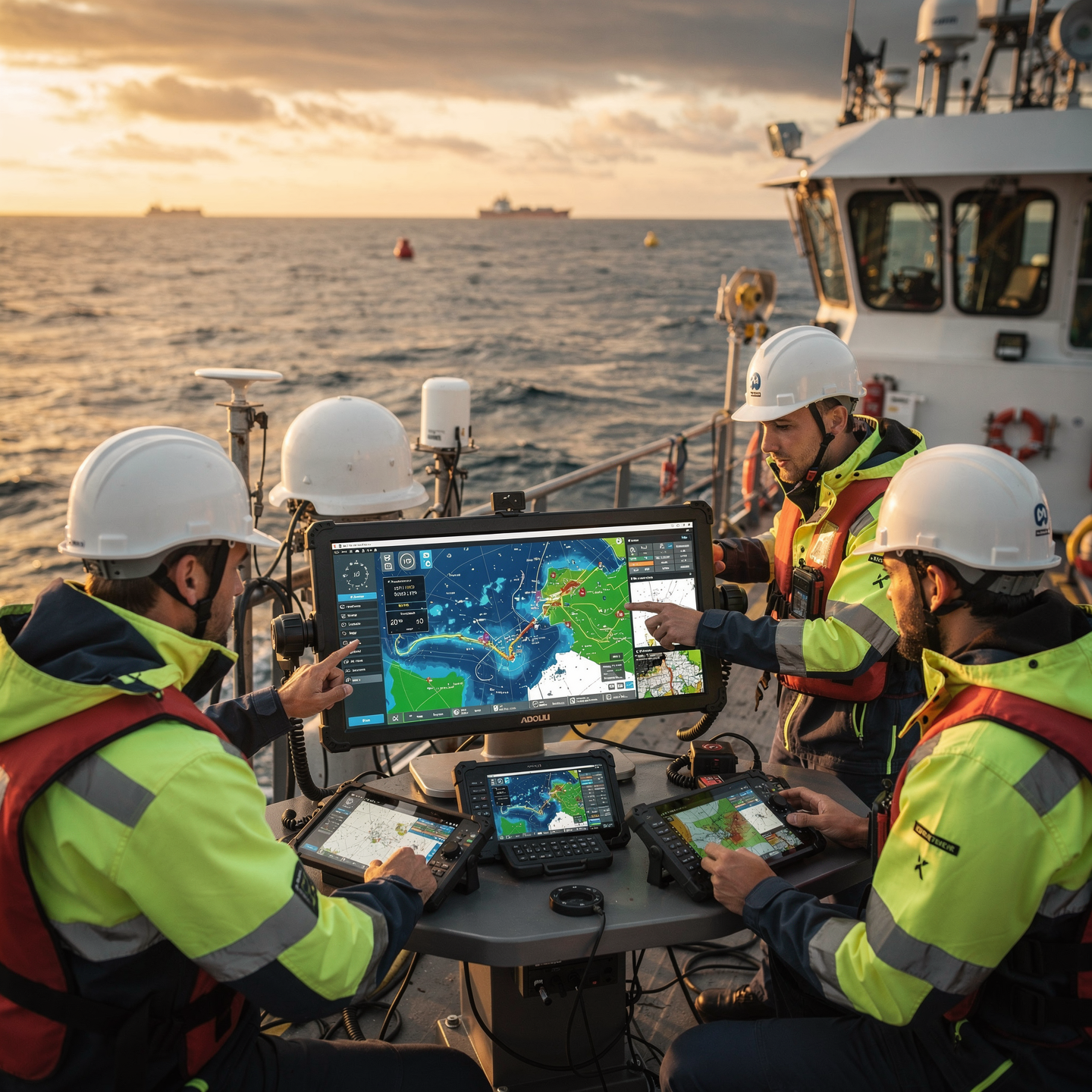
Integrate sensor data (GPS, AIS, radar) to create an accurate picture of the maritime environment and optimize the route.

Interpreting and analyzing digital cartographic information:
“Identify symbology, projections and datum, evaluating the accuracy and reliability of the information for the planning and execution of navigation.”

Manage and optimize maritime information systems:
“Implement and maintain backup and recovery procedures in the event of system failures, ensuring the integrity and availability of information critical to navigation.”

Implementing software solutions for maritime security:
Integrate sensor data (AIS, radar, ECDIS) to generate a complete view of the situation and alert about collision risks, intrusions into restricted areas or suspicious behavior, managing the information with cybersecurity protocols.
Integrate data from sensors and onboard systems:
“Transforming raw data into useful information for decision-making, considering the quality, reliability, and redundancy of the sources.”

Create innovative applications to improve the nautical experience:
“Develop predictive monitoring systems for motors and key components to anticipate failures and optimize maintenance, reducing downtime and costs.”
Curriculum - Modules
- Comprehensive Maritime Incident Management: protocols, roles, and chain of command for coordinated response
- Operational Planning and Execution: briefing, routes, weather windows, and go/no-go criteria
- Rapid Risk Assessment: criticality matrix, scene control, and decision-making under pressure
- Operational Communication: VHF/GMDSS, standardized reports, and inter-agency liaison
- Tactical Mobility and Safe Boarding: RHIB maneuvers, approach, mooring, and recovery
- Equipment and Technologies: PPE, signaling, satellite tracking, and field data logging
- Immediate Care of the Affected: primary assessment, hypothermia, trauma, and stabilization for evacuation
- Adverse Environmental Conditions: swell, Visibility, flows, and operational mitigation
Simulation and training: critical scenarios, use of VR/AR, and exercises with performance metrics
Documentation and continuous improvement: lessons learned, indicators (MTTA/MTTR), and SOP updates
- Introduction to Mobile App Development: Platforms, Languages, and Frameworks
- Fundamentals of Nautical Simulation: Mathematical Models, Physics of Motion, Marine Environment
- Digital Cartography: Data Formats (SHP, GeoJSON, MBTiles), Reference Systems, Projections
- Development of User Interfaces (UI) for Nautical Apps: Design, Usability, Accessibility
- Integration of Geographic Data: Map APIs (Leaflet, Google Maps), Web Services (WMS, WFS)
- Simulation of Nautical Sensors: GPS, Compass, Radar, AIS
- Calculation of Bearings and Distances: Geodesy, Rhumb Line and Great Circle Navigation
- Development of Planning Algorithms Routes: A*, Dijkstra, route optimization
- Nautical chart visualization: raster, vector, layer overlay, symbology
- Testing and deployment of nautical apps: simulation on mobile devices, publishing in app stores
‘
- Introduction to Electronic Navigation: History and Evolution
- Global Positioning Systems (GNSS): GPS, GLONASS, Galileo, Beidou
- Electronic Nautical Charts (ENC): Formats, Standards (S-57, S-63), Updates
- ECDIS Equipment: Operation, Configuration, and Basic Maintenance
- Maritime Safety Applications: AIS, DSC, LRIT, EPIRB, SART
- Marine Meteorology Applications: Forecasts, Alerts, and Visualization
- Use of Radar and ARPA Systems: Image Interpretation, Target Tracking
- Maritime Communications: VHF, MF/HF, Satellite Communications
- Cybersecurity in Electronic Navigation: Threats and Protection Measures
- Legislation and regulations applicable to electronic navigation and maritime safety
‘
- Introduction to Electronic Navigation: History, Evolution, and Future
- Fundamentals of Naval Simulation: Types of Simulators, Applications, and Limitations
- Electronic Navigational Chart Software (ECDIS): Installation, Configuration, and Basic Operation
- Simulation of Port Maneuvers: Berthing, Unberthing, Turning, and Anchoring
- Use of Radar and ARPA in Simulation: Detection, Tracking, and Collision Risk Assessment
- Integration of Global Positioning Systems (GNSS) in Simulators
- Simulation of Adverse Weather Conditions: Wind, Waves, Currents, and Reduced Visibility
- Simulation Tools for Emergency Management: Fires, Floods, breakdowns, and spills.
- Simulation data analysis: performance evaluation, error identification, and improved decision-making.
- Regulations and standards in electronic navigation and naval simulation.
‘
- Introduction to Electronic Navigation: History, Evolution, and Future
- Global Positioning Systems (GNSS): GPS, GLONASS, Galileo, BeiDou – Operation, Errors, and Limitations
- Electronic Navigational Charts (ENC) and Electronic Cartographic Information Systems (ECDIS): Standards, Symbology, Updates, and Management
- Radar and ARPA: Operating Principles, Image Interpretation, Target Tracking, and Collision Risk Calculation
- Automatic Identification Systems (AIS): Operation, Messages, Applications for Maritime Safety and Traffic
- Digital Nautical Instrumentation: Sounders, Logs, Anemometers, Gyrocompasses – Integration and Calibration
- Maritime Communications
Digital: GMDSS, DSC, Inmarsat – Emergency and Safety Procedures
Cybersecurity in Electronic Navigation: Threats, Vulnerabilities, and Protection Measures
Bridge Resource Management (BRM) in the Digital Age: Communication, Leadership, Decision-Making, and Fatigue Management
International Standards and Regulations: SOLAS, COLREG, STCW – Implications for Electronic Navigation and Maritime Safety
‘
- System Architecture and Components: Structural design, materials, and subsystems (mechanical, electrical, electronic, and fluid) with selection and assembly criteria for marine environments
- Fundamentals and Principles of Operation: Physical and engineering foundations (thermodynamics, fluid mechanics, electricity, control, and materials) that explain performance and operating limits
- Safety and Environmental (SHE): Risk analysis, PPE, LOTO, hazardous atmospheres, spill and waste management, and emergency response plans
- Applicable Regulations and Standards: IMO/ISO/IEC requirements and local regulations;
- Conformance criteria, certification, and best practices for operation and maintenance
- Inspection, testing, and diagnostics: Visual/dimensional inspection, functional testing, data analysis, and predictive techniques (vibration, thermography, fluid analysis) to identify root causes
- Preventive and predictive maintenance: Hourly/cycle/seasonal plans, lubrication, adjustments, calibrations, consumable replacement, post-service verification, and operational reliability
- Instrumentation, tools, and metrology: Measuring and testing equipment, diagnostic software, calibration and traceability; selection criteria, safe use, and storage
- Onboard integration and interfaces: Mechanical, electrical, fluid, and data compatibility; Sealing and watertightness, EMC/EMI, corrosion protection, and interoperability testing.
Quality, acceptance testing, and commissioning: process and materials control, FAT/SAT, bench and sea trials, go/no-go criteria, and evidence documentation.
Technical documentation and integrated practice: logs, checklists, reports, and a complete case study (safety → diagnosis → intervention → verification → report) applicable to any system.
- Introduction to Electronic Navigation: History, Evolution, and Future
- Fundamentals of Nautical Cartography: Projection, Datum, Scales, and Accuracy
- Global Positioning Systems (GNSS): GPS, GLONASS, Galileo, BeiDou
- Nautical Applications (Apps): Types, Functions, Advantages, and Limitations
- Digital Nautical Charts (ENC): S-57/S-63 Standards, Formats, and Providers
- Installing and Configuring Apps and Nautical Charts on Mobile Devices and Computers
- Using Apps for Route Planning: Creation, Editing, and Optimization
- Real-Time Navigation with Apps and Nautical Charts: Tracking, alarms, and security
Integration with other onboard systems: AIS, Radar, Autopilot
Updating and maintaining apps and nautical charts: procedures and best practices
‘
Career opportunities
- Nautical Application Developer: Creation and maintenance of apps for navigation, marine meteorology, and fleet management.
- Digital Cartographer: Production and updating of electronic nautical charts, marine geospatial databases, and 3D models of the seabed.
- ECDIS Systems Specialist: Installation, configuration, technical support, and training in the use of electronic chart display systems.
- Nautical Digitization Consultant: Advising companies in the maritime sector on the implementation of digital solutions for process optimization.
- Marine Data Analyst: Processing and analysis of navigation, meteorology, and oceanography data to improve maritime safety and operational efficiency.
- Nautical Systems Integrator: Development of solutions for the integration of different navigation and communication systems. and onboard vessel control.
- Nautical Software Technical Support: troubleshooting technical issues, customer service, and training in the use of specialized marine software.
- Marine Technology Researcher: developing new technologies and applications for navigation, cartography, and marine environmental management.
“`
Admission requirements

Academic/professional profile:
Degree/Bachelor's degree in Nautical Science/Maritime Transport, Naval/Marine Engineering, or a related field; or proven professional experience in bridge/operations.

Language proficiency:
Recommended functional maritime English (SMCP) for simulations and technical materials.

Documentation:
Updated resume, copy of degree or seaman's book, ID card/passport, letter of motivation.

Technical requirements (for online):
Equipment with camera/microphone, stable connection, ≥ 24” monitor recommended for ECDIS/Radar-ARPA.
Admission process and dates

1. Online
application
(form + documents).

2. Academic review and interview
(profile/objectives/schedule compatibility).

3. Admission decision
(+ scholarship proposal if applicable).

4. Reservation of place
(deposit) and registration.

5. Induction
(access to campus, calendars, simulator guides).
Scholarships and grants
- Advanced Digital Cartography: Master the tools and techniques for creating and managing electronic nautical charts.
- Essential Maritime Apps: Learn to use and develop mobile applications for navigation, safety, and maritime operations management.
- Professional Electronic Navigation: Delve into Electronic Chart Display and Information Systems (ECDIS) and their integration with other onboard equipment.
- Maritime Data Analysis: Interpret and apply oceanographic and meteorological data to optimize routes and improve real-time decision-making.
- Simulations and Case Studies: Apply the knowledge acquired in real and simulated scenarios to strengthen your practical skills.
Testimonials
The Diploma in Nautical Software exceeded my expectations. I acquired solid skills in digital cartography and maritime app development, allowing me to create an application for the efficient management of navigation routes that I currently use in my work, optimizing the company’s time and resources.
The Diploma in Practical Innovation provided me with the tools and practical approach I needed to drive innovation in my company. I learned to identify opportunities, apply agile methodologies, and develop functional prototypes, resulting in the successful launch of a new product that exceeded our sales expectations by 25% in the first quarter.
This diploma program exceeded my expectations. I gained a solid foundation in digital cartography and maritime app development, enabling me to create an application for calculating optimal routes based on variables such as currents and winds. I’m already using it at work with excellent results, optimizing navigation times and fuel consumption.
The Diploma in Nautical Software exceeded my expectations. I acquired solid skills in digital cartography and maritime app development, applying my knowledge to a final project that simulated a navigation application with tide information, updated charts, and optimized routes. This hands-on experience led to an internship at a nautical software development company.

Frequently asked questions
Nautical software, including digital mapping software and maritime apps.
Yes. The itinerary includes ECDIS/Radar-ARPA/BRM with harbor, ocean, fog, storm, and SAR scenarios.
Online with live sessions; hybrid option for simulator/practical placements through agreements.
Nautical software, including digital mapping software and maritime apps.
Recommended functional SMCP. We offer support materials for standard phraseology.
Yes, with a relevant degree or experience in maritime/port operations. The admissions interview will confirm suitability.
Optional (3–6 months) through Companies & Collaborations and the Alumni Network.
Simulator practice (rubrics), defeat plans, SOPs, checklists, micro-tests and applied TFM.
A degree from Navalis Magna University + operational portfolio (tracks, SOPs, reports and KPIs) useful for audits and employment.
- Introduction to Electronic Navigation: History, Evolution, and Current Trends
- Fundamentals of Marine Electronics: Voltages, Currents, Sensors, and Actuators
- Onboard Networks: Protocols (NMEA 0183, NMEA 2000), Connectivity, and Diagnostics
- Communication Systems: VHF, MF/HF, Inmarsat, GMDSS
- Global Positioning Systems (GNSS): GPS, GLONASS, Galileo, BeiDou
- Data Integration: Information Centralization and Visualization
- Navigation Sensors: Gyro, Log, Echosounder, Anemometer, Radar
- Software Tools for Route Planning and Data Analysis
- Cybersecurity in Navigation
- Basic Maintenance and Troubleshooting of Electronic Navigation Equipment
Electronics: Threats, Vulnerabilities, and Protection Measures
‘
Request information
Complete the Application Form.
Attach your CV/degree certificate (if you have it to hand).
Indicate your preferred cohort (January/May/September) and whether you would like the hybrid option with simulator sessions.
An academic advisor will contact you within 24–48 hours to guide you through the admission process, scholarships, and compatibility with your professional schedule.
Faculty
Eng. Tomás Riera
Full Professor
Eng. Tomás Riera
Full Professor
Eng. Sofía Marquina
Full Professor
Eng. Sofía Marquina
Full Professor
Eng. Javier Bañuls
Full Professor
Eng. Javier Bañuls
Full Professor
Dr. Nuria Llobregat
Full Professor
Dr. Nuria Llobregat
Full Professor
Dr. Pau Ferrer
Full Professor
Dr. Pau Ferrer
Full Professor
Cap. Javier Abaroa (MCA)
Full Professor
Cap. Javier Abaroa (MCA)
Full Professor